
About Picture this UK
Picture this UK (picturethisuk.org) Contains:- Best Places to Photograph in London, Best Places to Photograph near London, Best Places to Visit in London, Best Places to Visit near London, Best places to see in London and 100 + places to visit in London. Both inside and out.
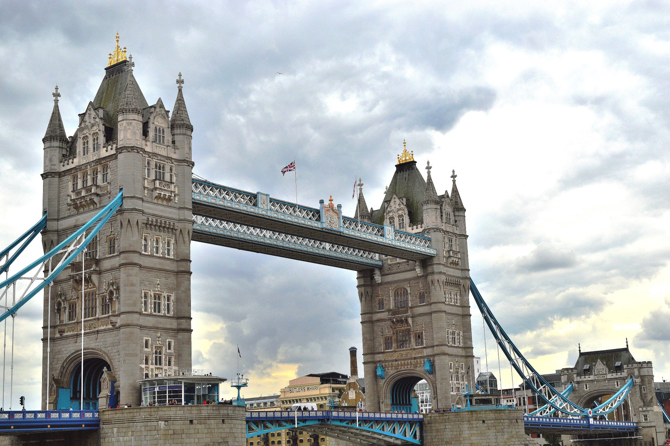
Tower Bridge

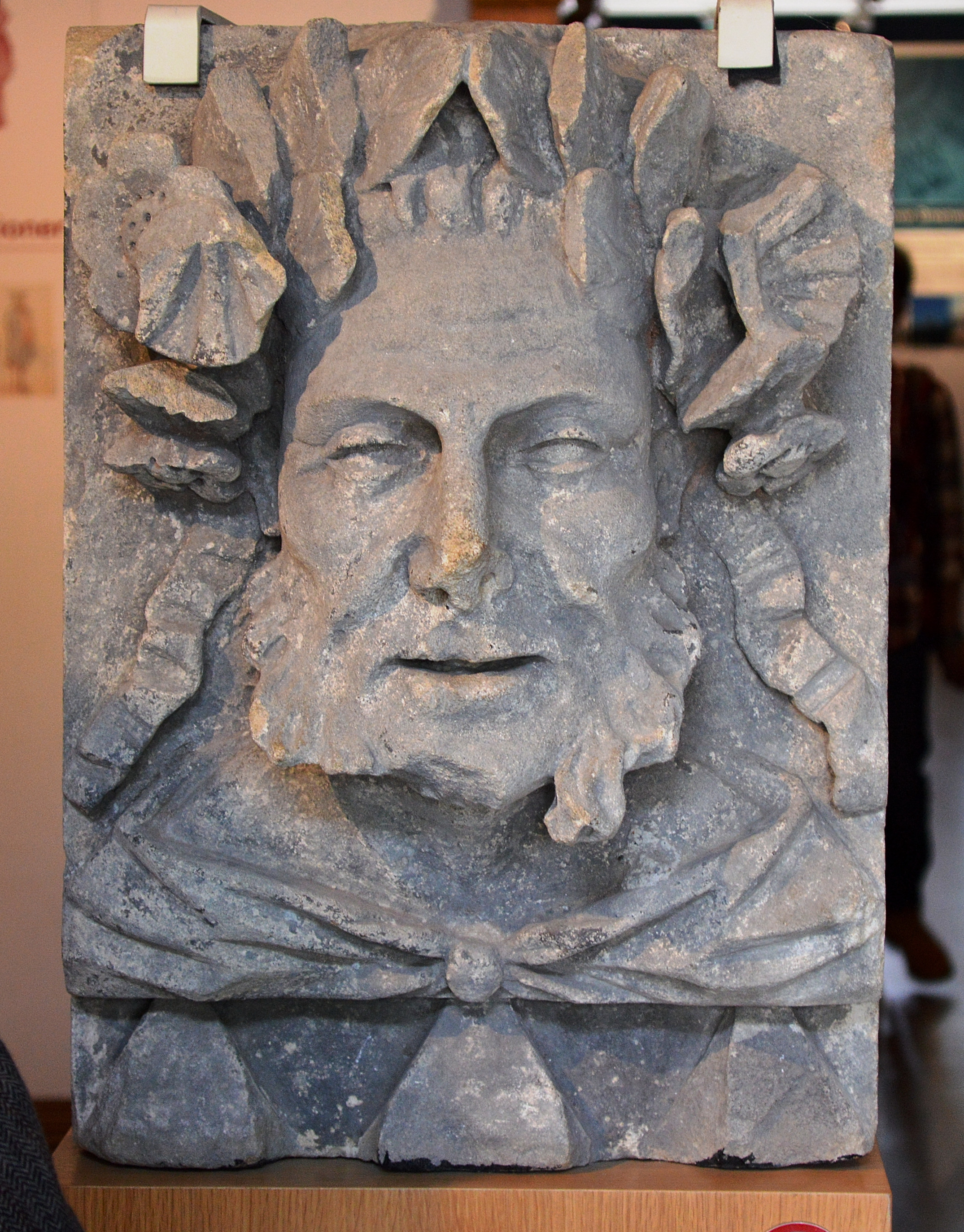
British Museum
Please click on the ⇒Gallery⇐ for more
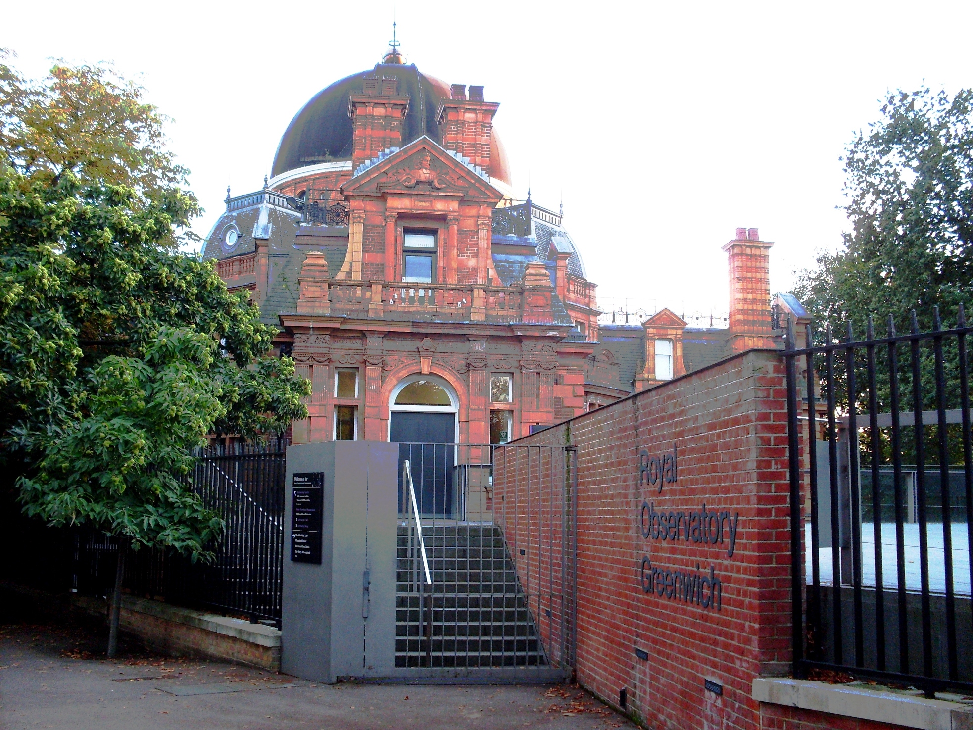
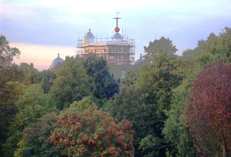
Greenwich Royal Observatory
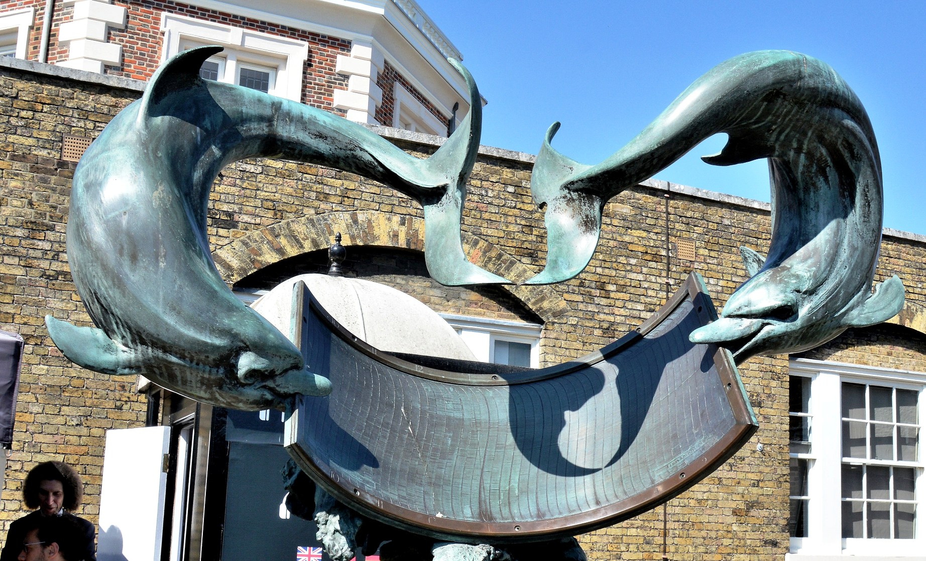
The Greenwich Royal Observatory includes Flamsteed House and the Harrison Timekeepers ⇐. In the midst is a small garden with this very impressive Dolphin Sun Dial.
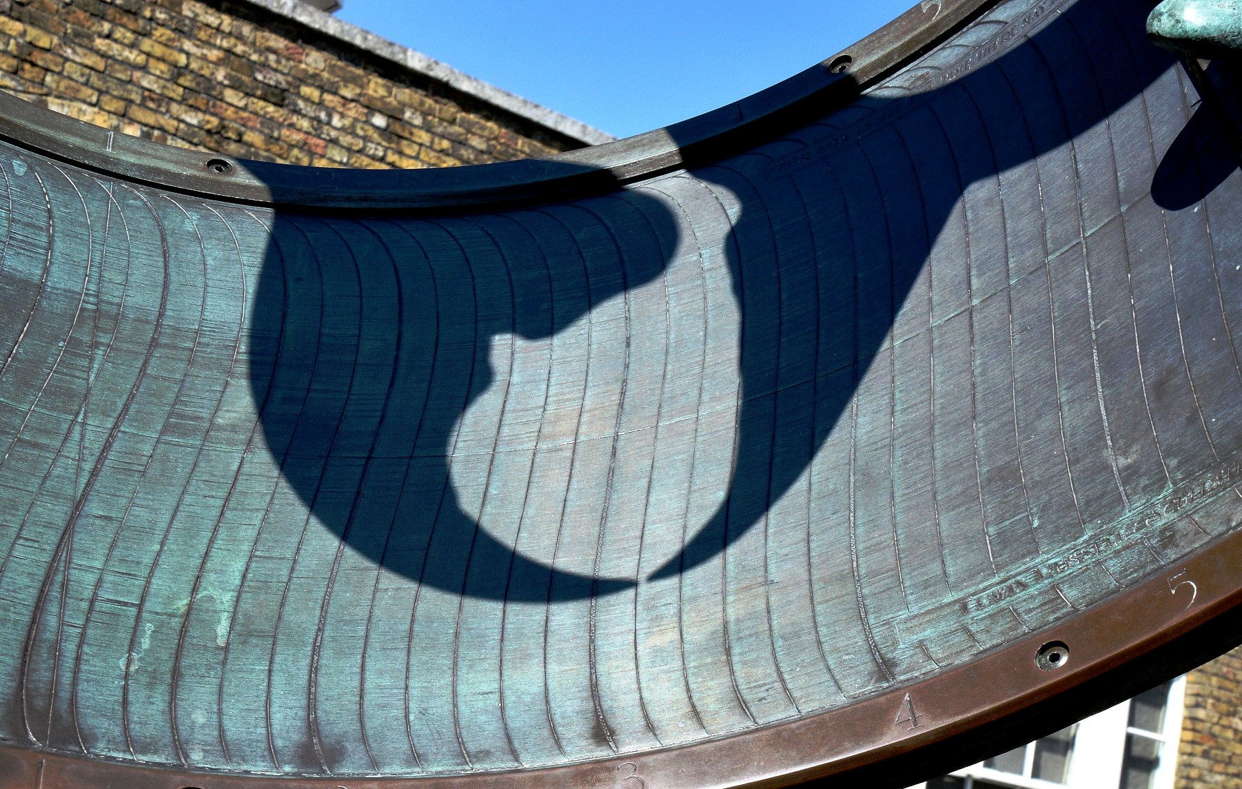
The sun-dial is self-adjusting. As the height of the sun changes with the time of the year, the shadow position changes its height and so indicates a corrected time..

The Greenwich Royal Observatory and Flamsteed House.

Inside the onion dome is the largest refracting telescope in the UK. First used in 1893, it remains one of the largest refracting telescopes ever built. Entry is free except the night sky observation evening. For more and to find out about night sky observation evenings please click here ⇒ .
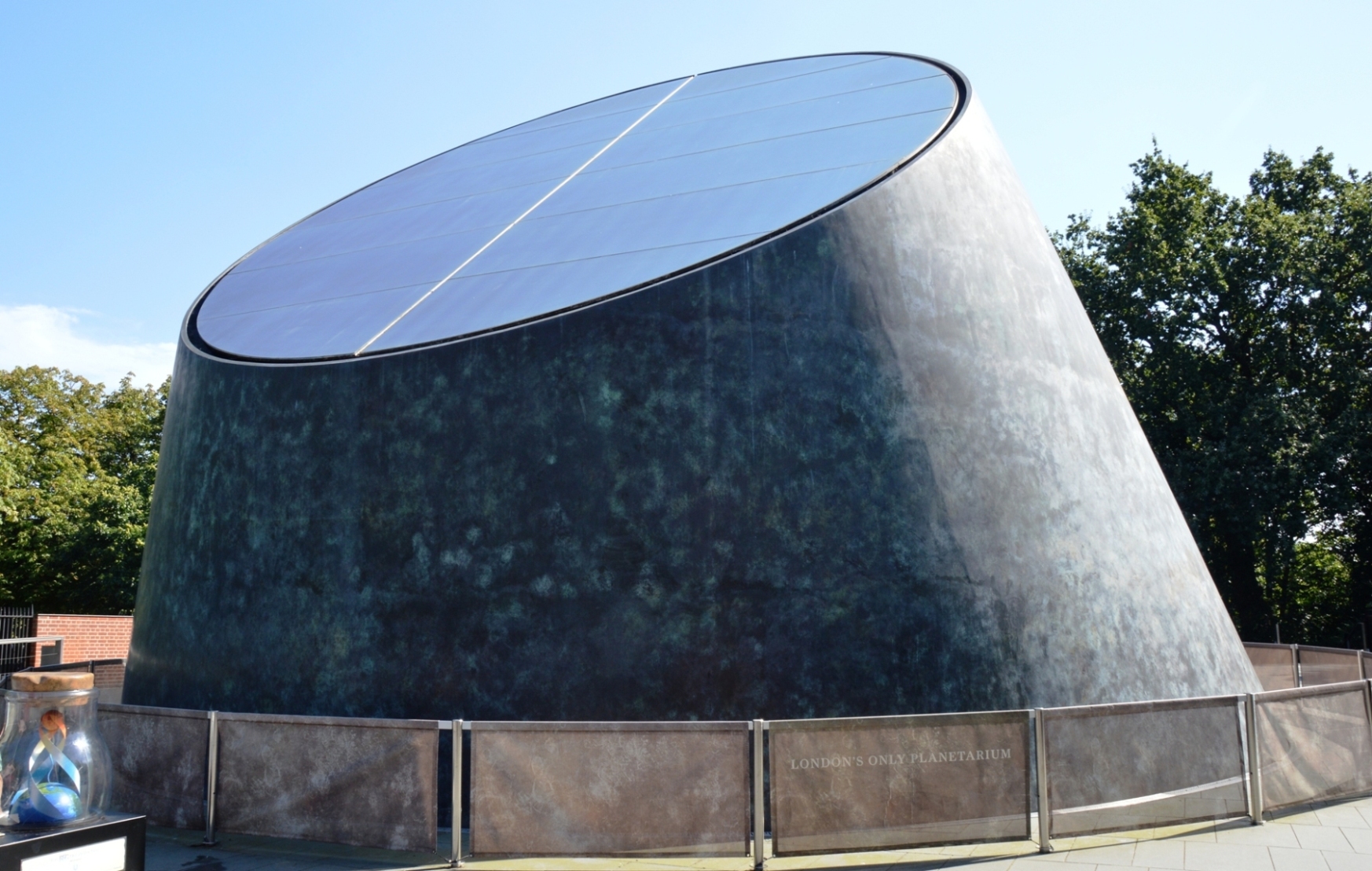
The Planetarium ⇒for which there is a charge.

The Astronomy Center ⇒ is mostly educational and is free to enter.

.
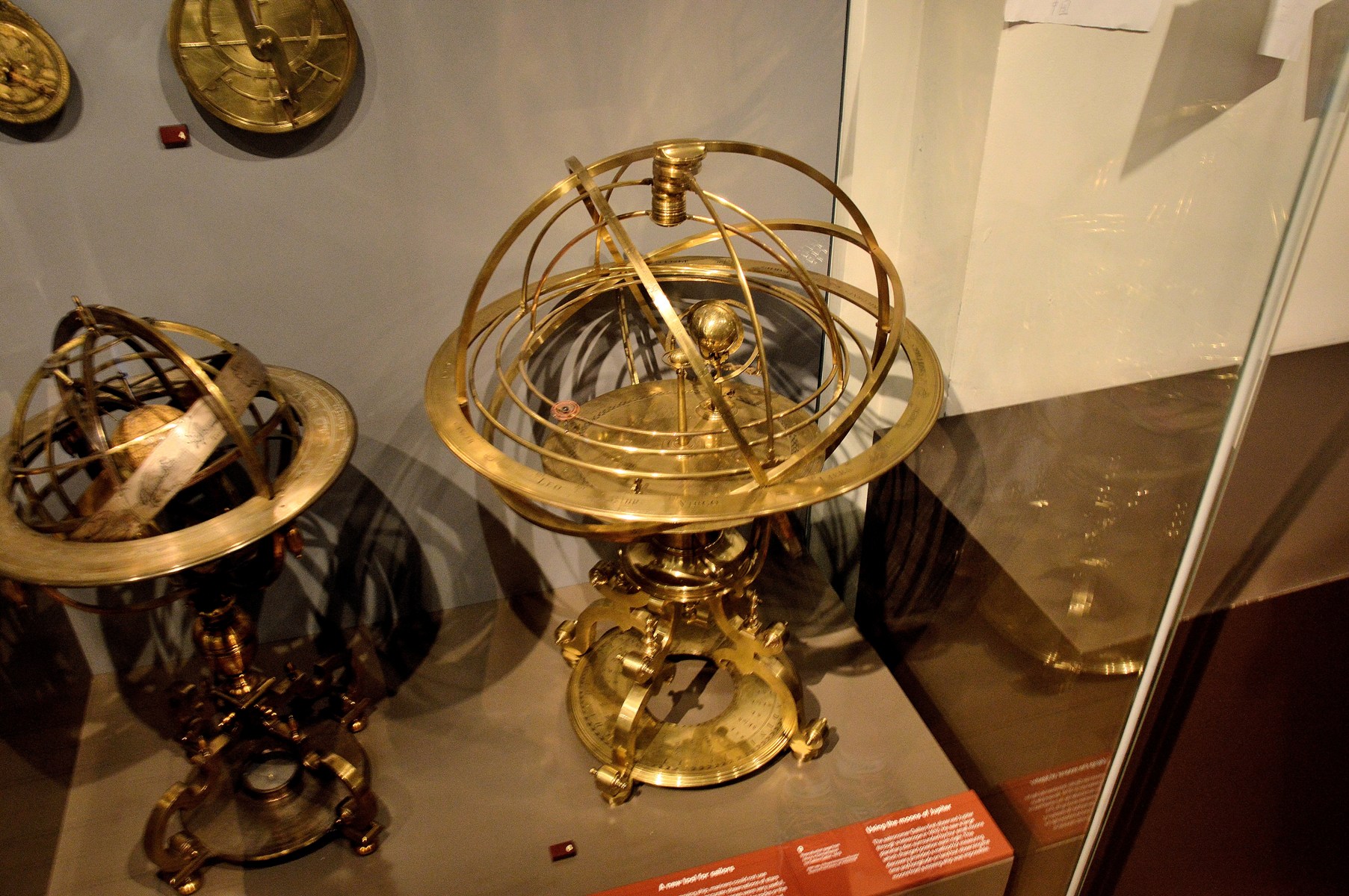
Astrolabes and Armillary Spheres were used to predict/exhibit planet and moon positions..

Visitors to the Astronomy Center can touch part of the Gibeon Meteorite ⇒. At 4.5 billion years old it is the oldest thing that a mere earthling might touch.

An early spectroscope. Spectroscopy ⇒.
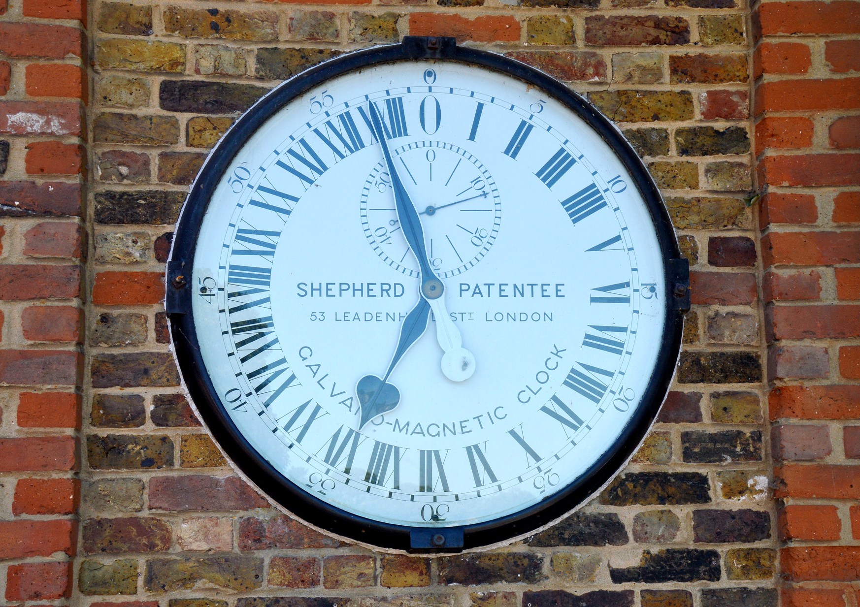
Outside the Meridian Courtyard ⇐ is a 24 hour electric clock. The use of roman numerals means that it is actually indicates 2 pm.
And, there is a lot more to see and do at Wonderful Greenwich⇐.

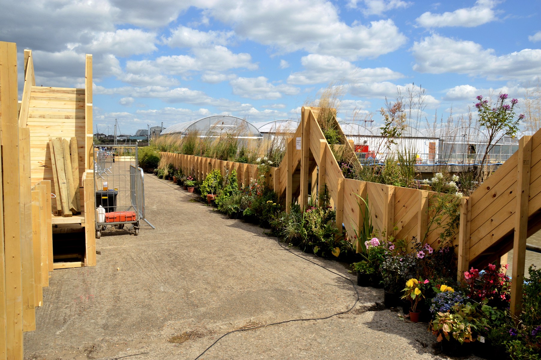
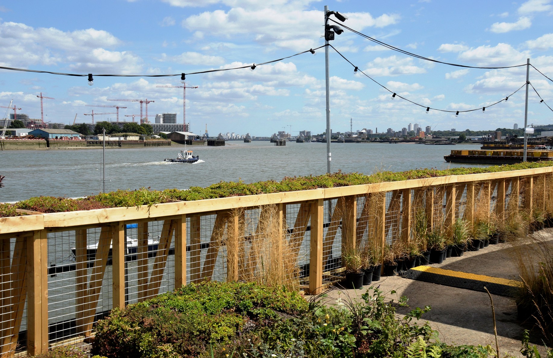
Farmopolis
Farmopolis ⇒ is an ambitious project very near to the O2 arena on the Greenwich Peninsula. At present only a very small part has been built and is still a work in progress. It consists of a small café/restaurant with some indoor and outdoor seating and surrounded by plants rescued from the Chelsea Flower Show. These plantings should be complete by the end of August 2016.
Like many such venues I found the food and drink rather pricey and pretentious, but there are plenty of places nearby where a picnic can be enjoyed. There are events ⇒ at the site and the flowers are worth seeing.
Below is a view from the United Emirates Cable Car ⇐.

.
.
.

.
.

.

.

.

.

.

.
.

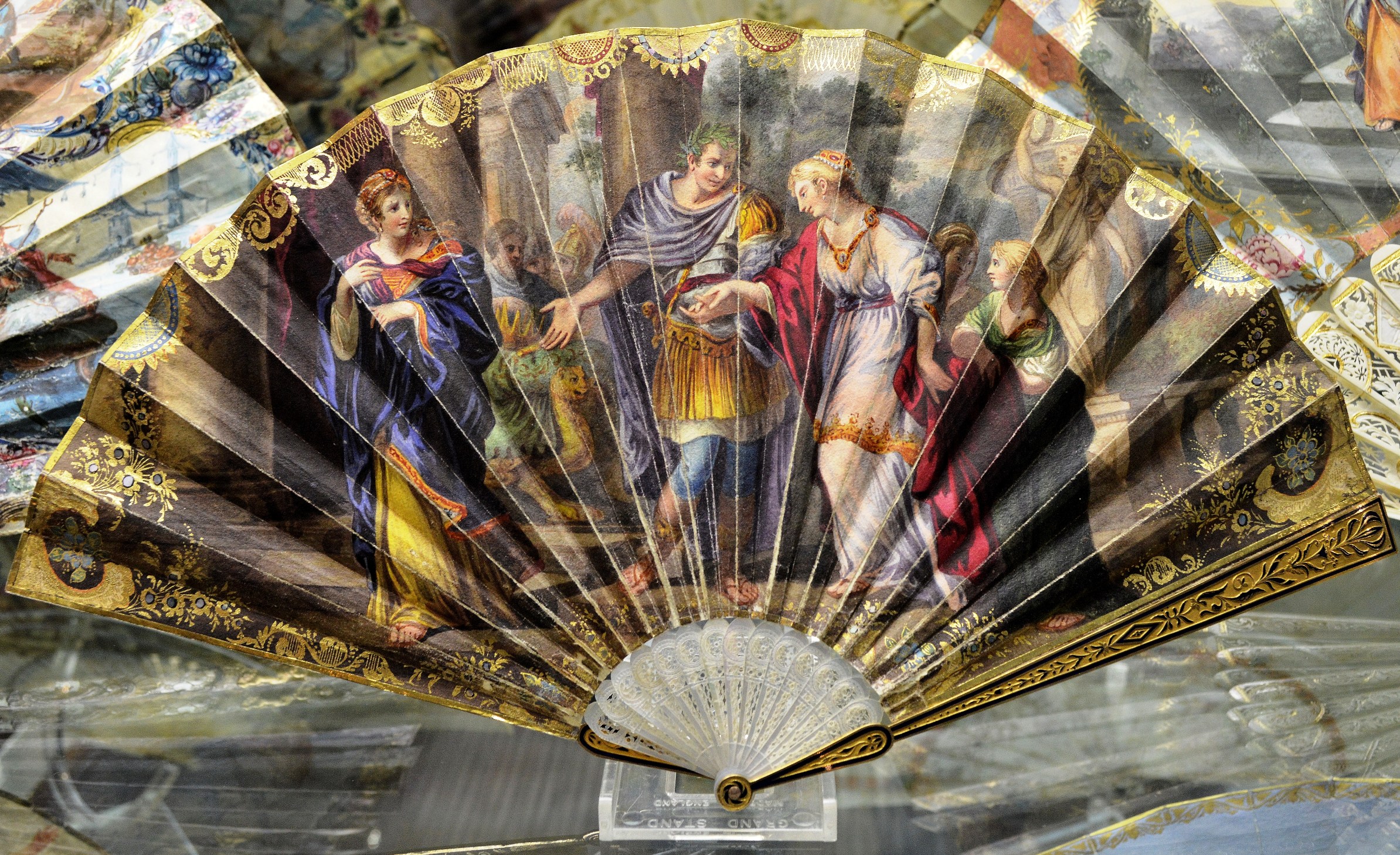
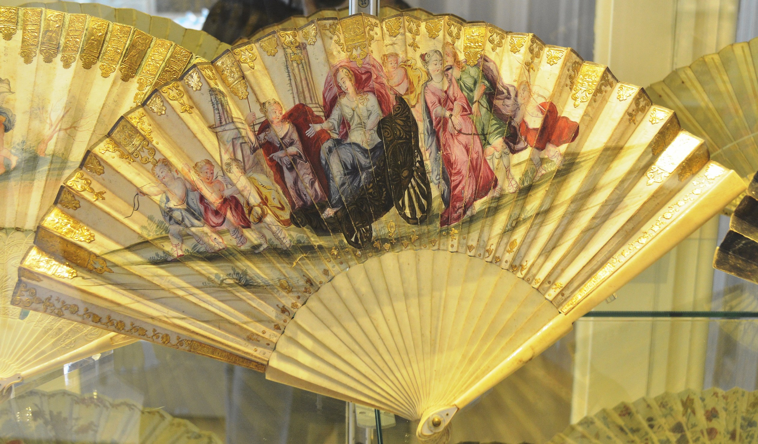
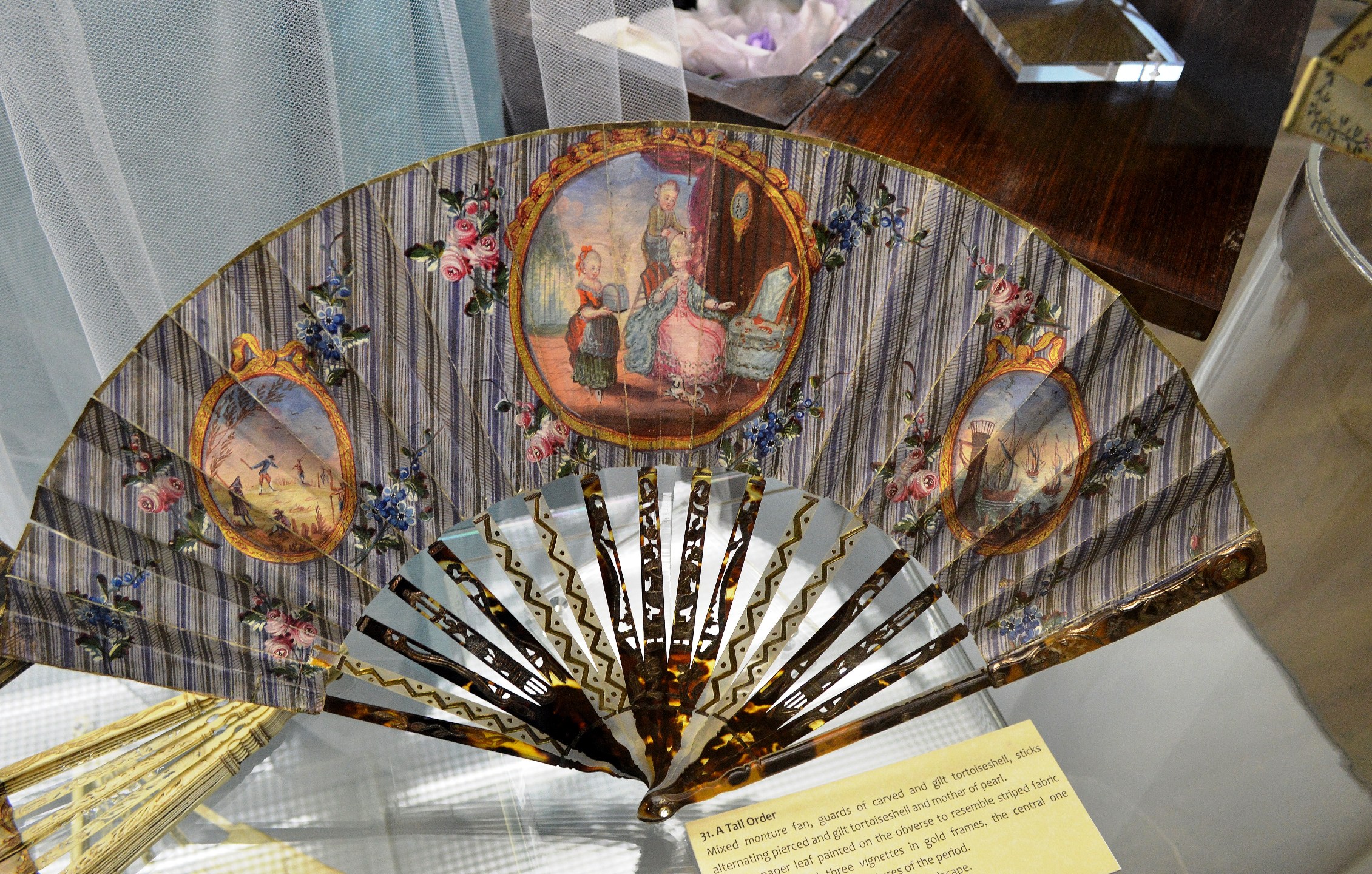
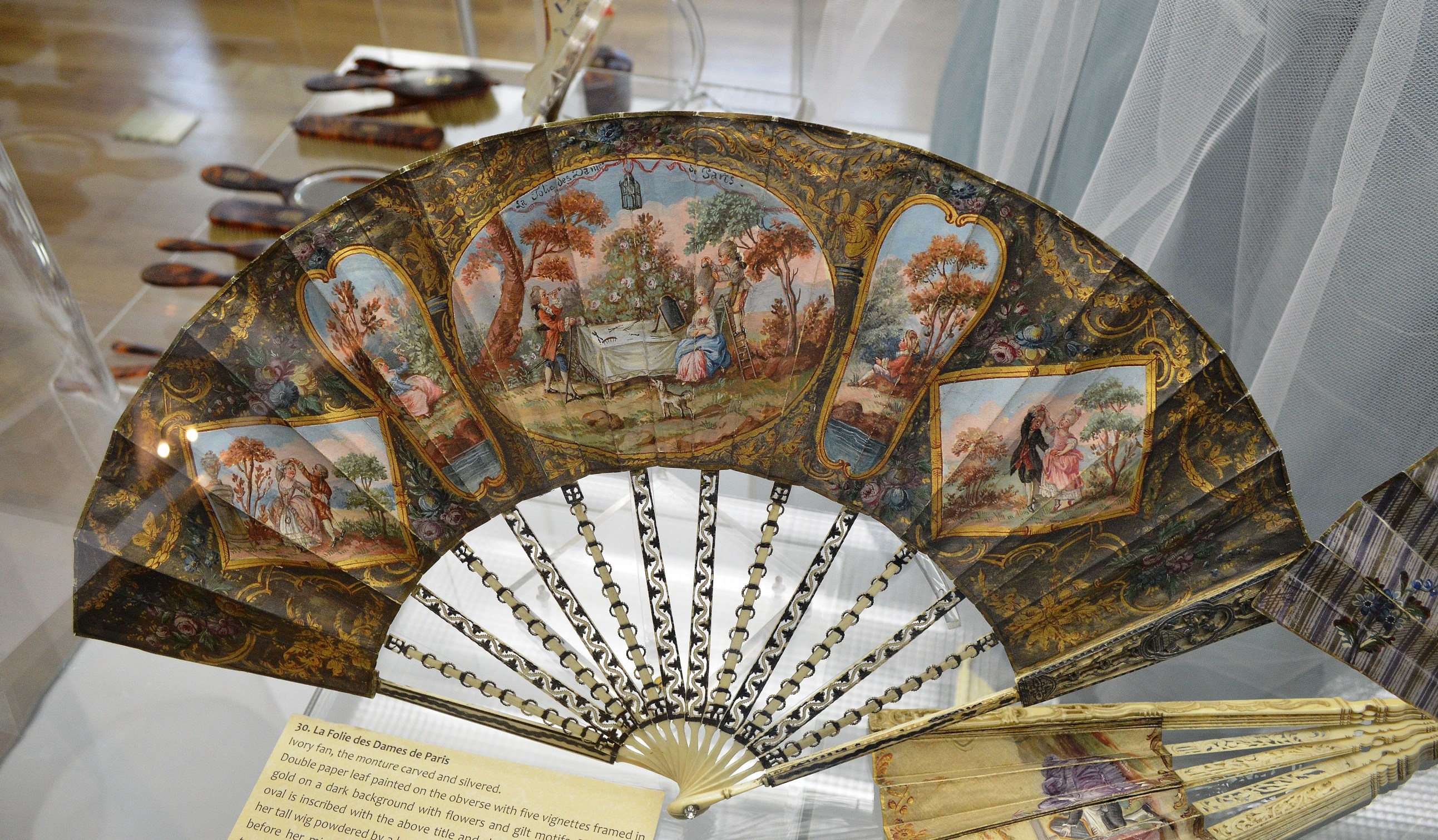
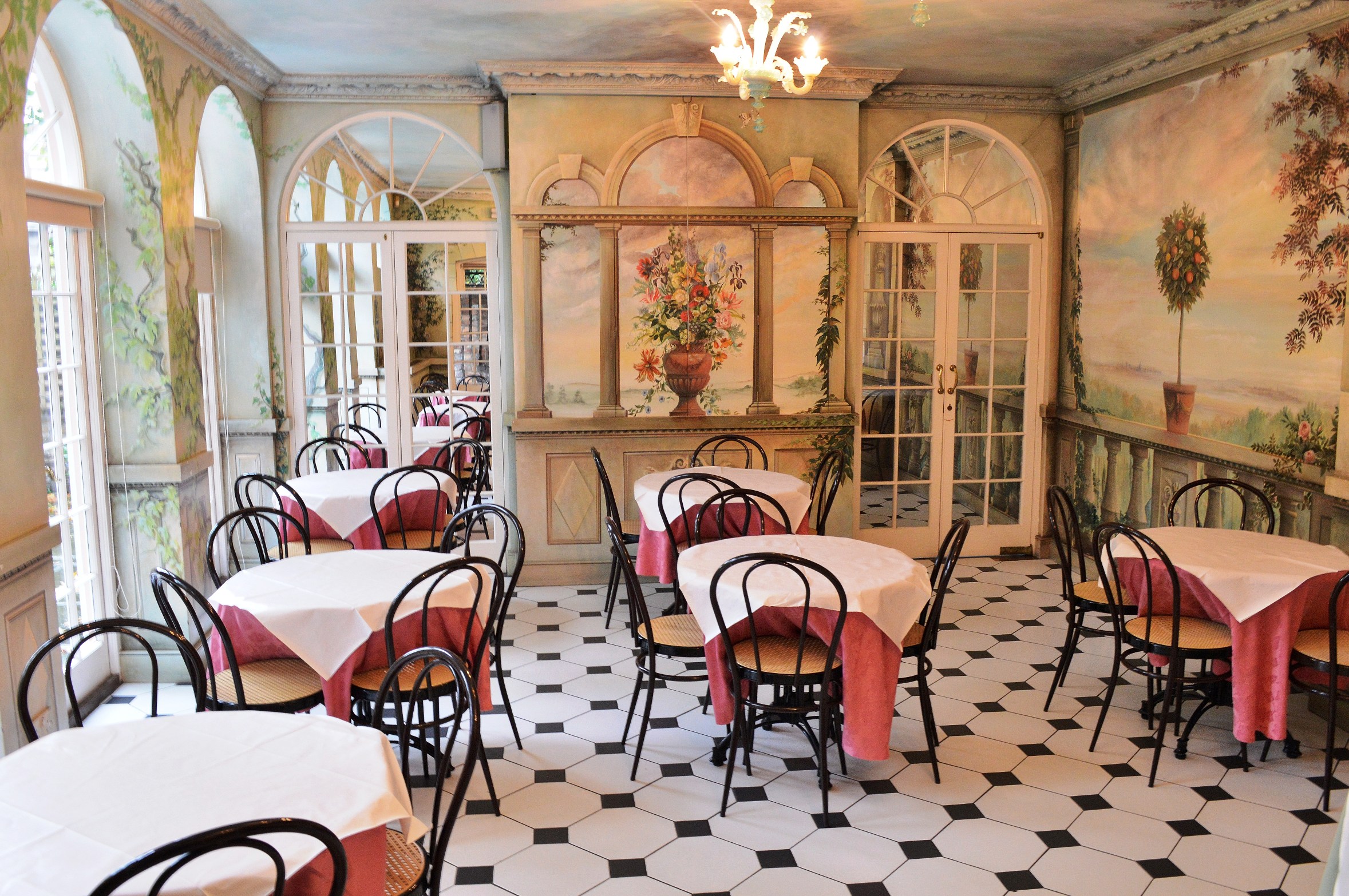
The Fan Museum at Greenwich
The Fan Museum is at 12 Croom St, Greenwich and, at just £4 entry fee with numerous concessions, is well worth a visit. The museum is thought to be the only museum, dedicated to fans, in the world. There is also a charming Orangery style tea room (you do need to book ahead)
The museum is quite small but has a number of activities and events. You can also create or commission your own designs. For more information please click here and then start with “Practical Information” from the side menu. For more of the many attractions at Greenwich please click here.
The Fans
It is well worth seeing the finer details, which are little obscured by the folds. To do so, please click on the image for full screen and then again to magnify. To return here use the “back arrow” screen button on your browser.

.
.

.

.
.

.
.
.

.

.
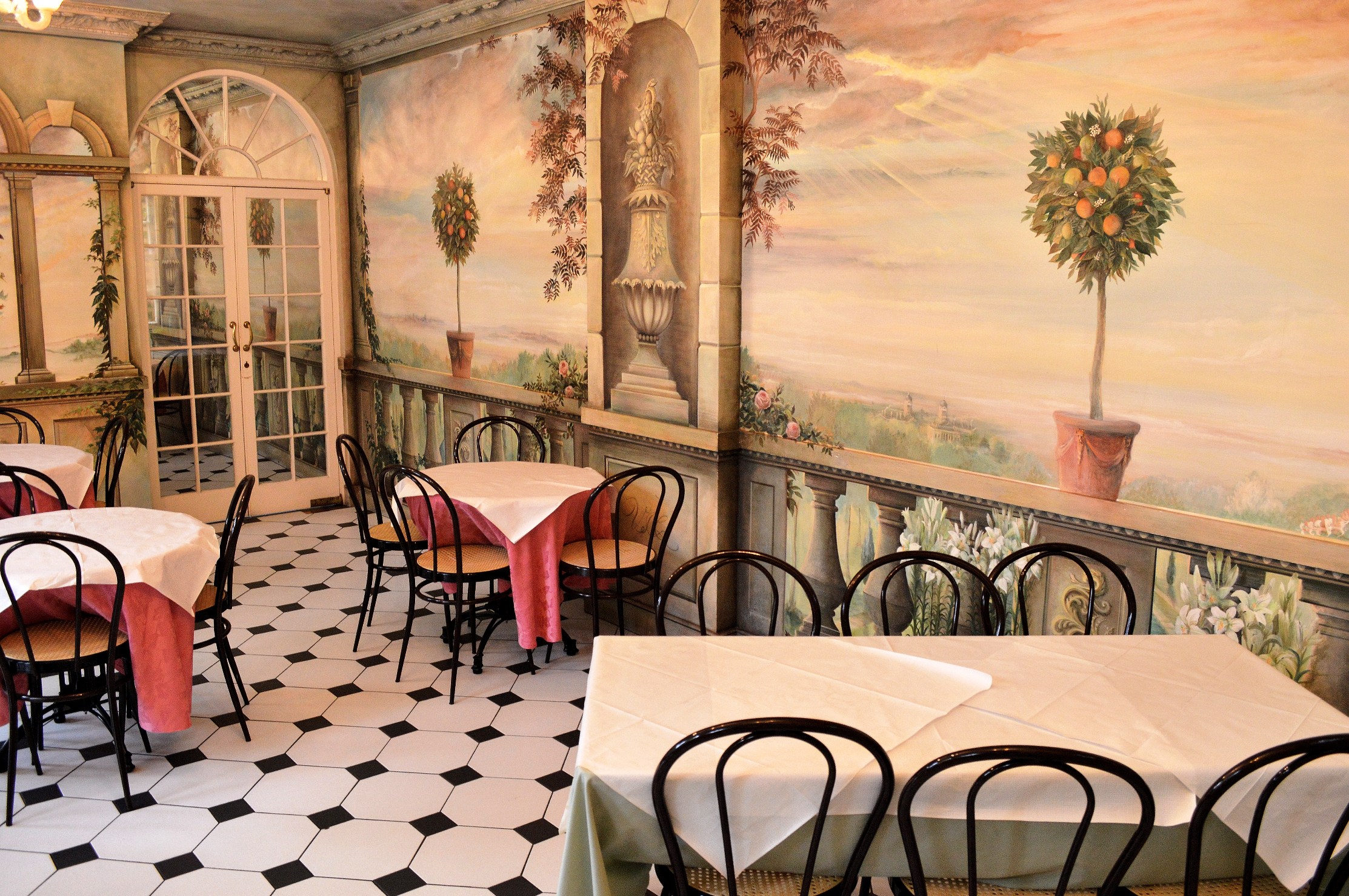
The Orangery Tea Rooms
You might notice the false shadow that has been painted on to give a 3D effect. You will need to book for tea, so please see the website (the link is at the top).

Characters at the Greenwich Tall Ships Festival
Characters (18 pics)

I’m a star. – Those on the other end of the lead were watching the river and had no idea what their dog was doing. She was drawing a little crowd of her own. The words “what a character” were often heard. She wins my first prize for “Character of the Festival”.
A close second comes :-

Please click on an image to expand and view a slideshow:-


The Crews

Please click on an image to expand and view slide show:-


And, then click on
And, thank you for your visit.
The Tall Ships at Greenwich
The Greenwich Tall Ships Festival
14 pics. The Festival brought a group of tall ships up the Thames for the first time in 25 years. They met from all over the world at Falmouth and raced to Greenwich. During the last day parade the wind was not favourable to sail. Hats off to the skippers for making sail for the spectators, even though it meant expending extra fuel to make progress. There were 50+ taking part. Here are a few.
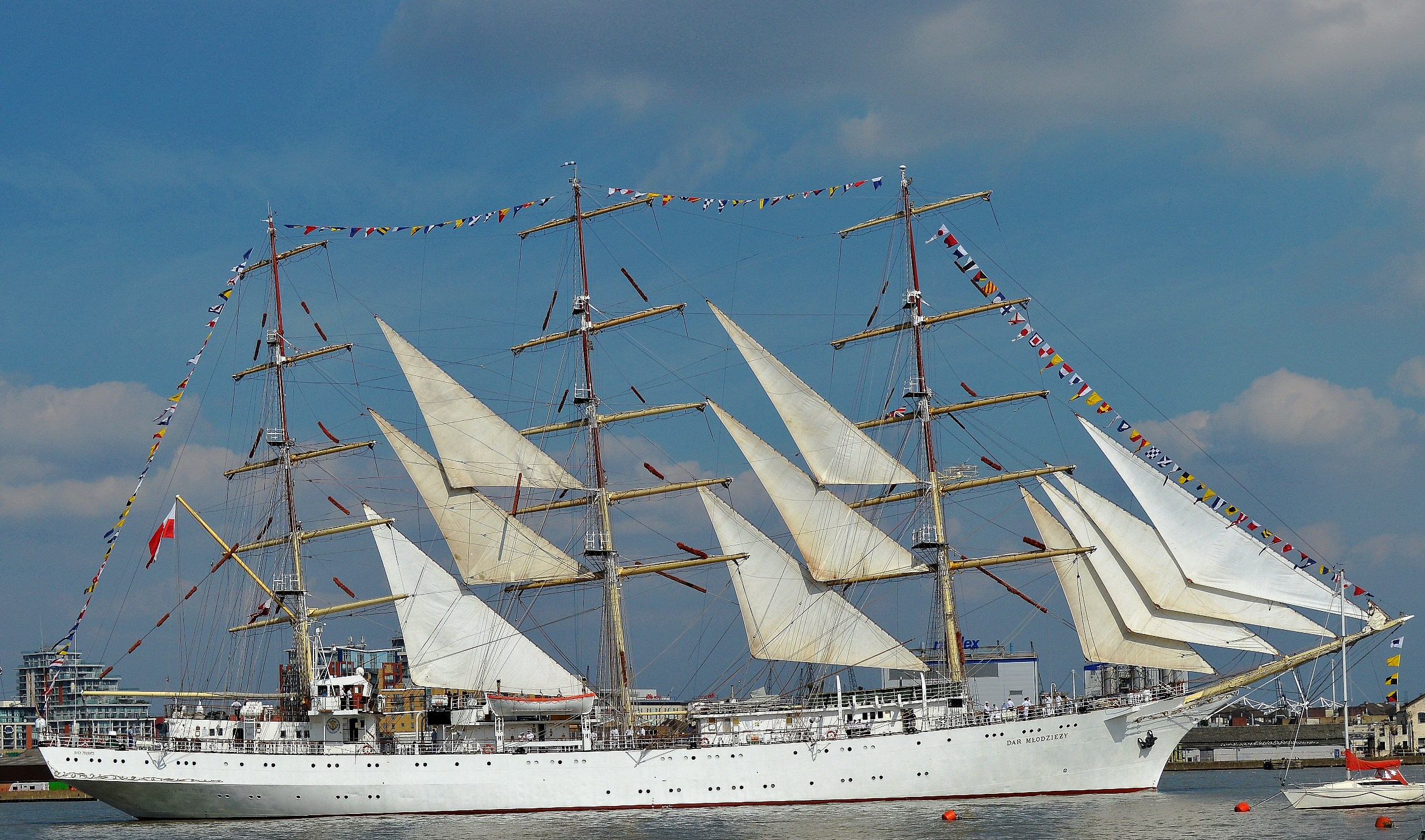
Dar Mlodziezy
Dar Mlodziezy, which dwarfed all the other vessels, won the first in it’s class (A).

Duet
Duet won first in it’s class (B) and first overall. It is a yawl. That is, it has an additional mast/sail aft of it’s rudder. The design was originally created to add extra sail without breaking the design rules for it’s racing class. That, together with a big mainsail and two additional foresail(s) on it’s bowsprit, makes a very powerful rig that takes skill to handle well. The Cirdan Trust ⇒. Pictures under sail (updated) ⇒.

Stavros S Niarchos
The Stavros S Niarchos won the communications prize for doing the most to aid the race schedule communications.

Tenacious
Tenacious was a mix of able bodied and less able bodied crew. They did well to gain third in their class (A)

Gulden Leeuw
The Golden Leeuw won the the Friendship Trophy for having contributed the most towards international friendship and understanding. They were also the most international crew and won the Young Trainee Award.
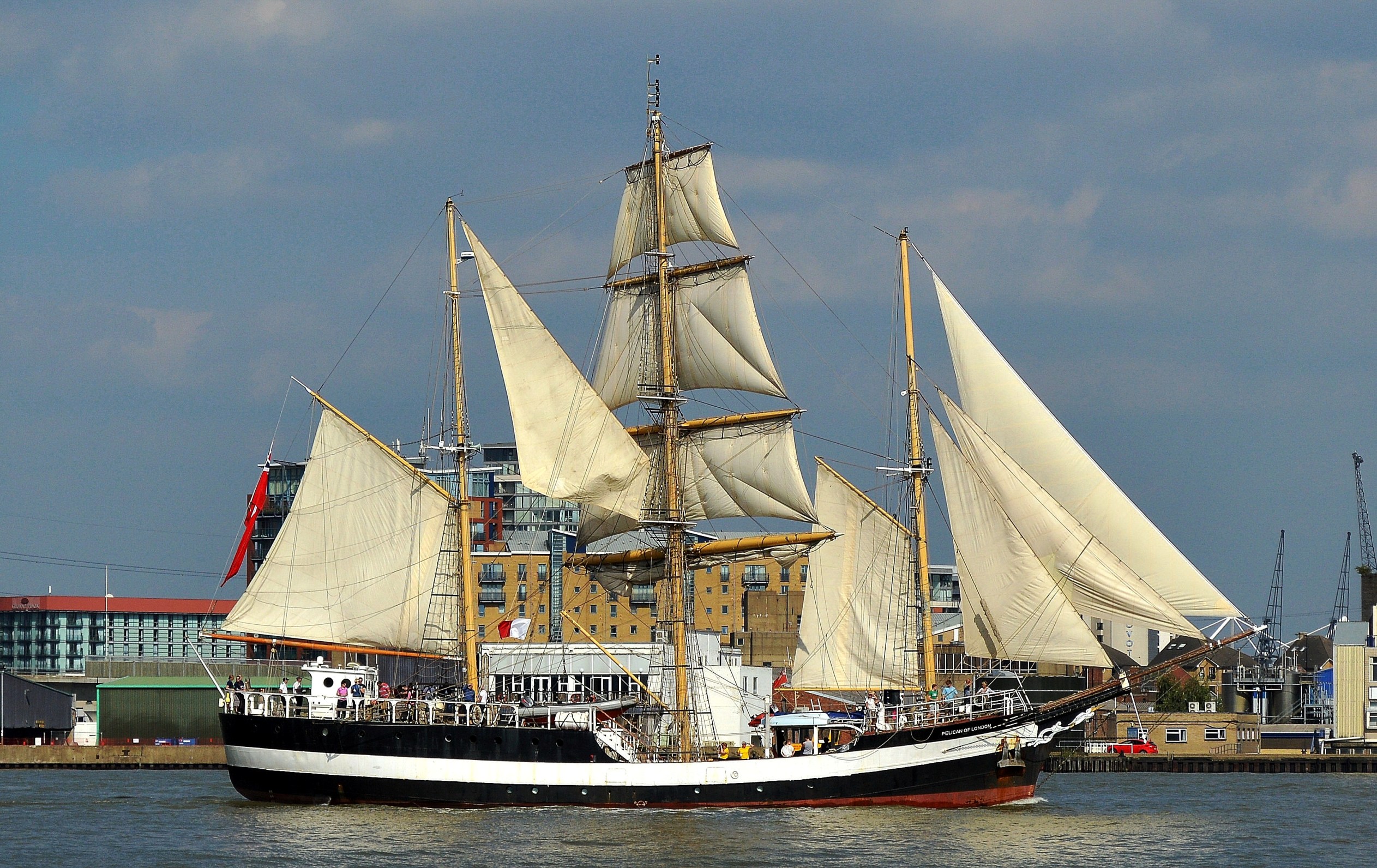
Pelican of London
The youngest Captain (Tom Whiteford)

J.R. Tolkien

Loth Lorien

Morgenster

Oosterschelde
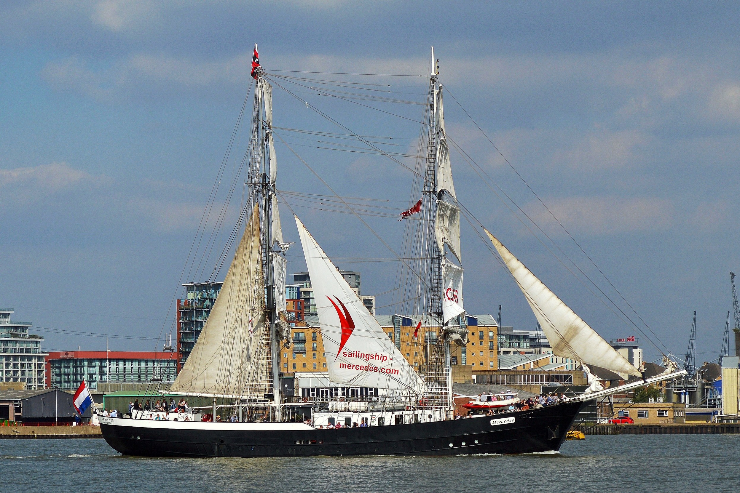
Mercedes

Swan

Pirate
I couldn’t get the name of this one but it certainly caught everybody’s attention. Most particularly because it had a working cannon which they delighted in using, making everybody jump and producing great clouds of smoke. They even had the cheek to fire it in the vicinity of Woolwich Arsenal. In past days they would have been blown to bits.
Royal Barge
The Royal Barge appeared two days earlier and is the one used for the Queens Jubilee. Sixty years in the same job and they didn’t even give her one with an engine. A close look at the those on the oars would indicate that they have probably been quaffing something.
Next, click on – The Festival and it’s characters.
And, thank you for visiting.
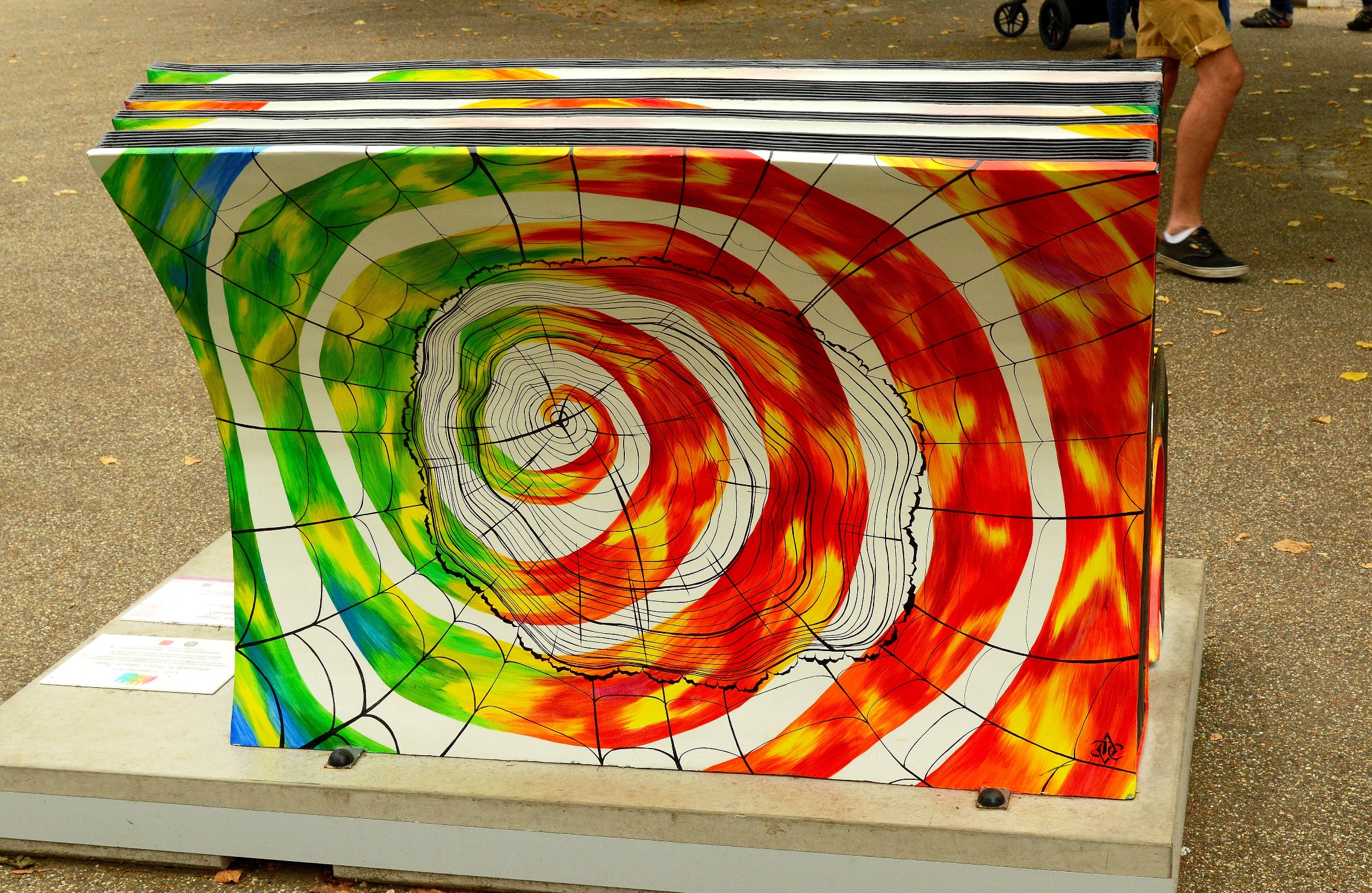
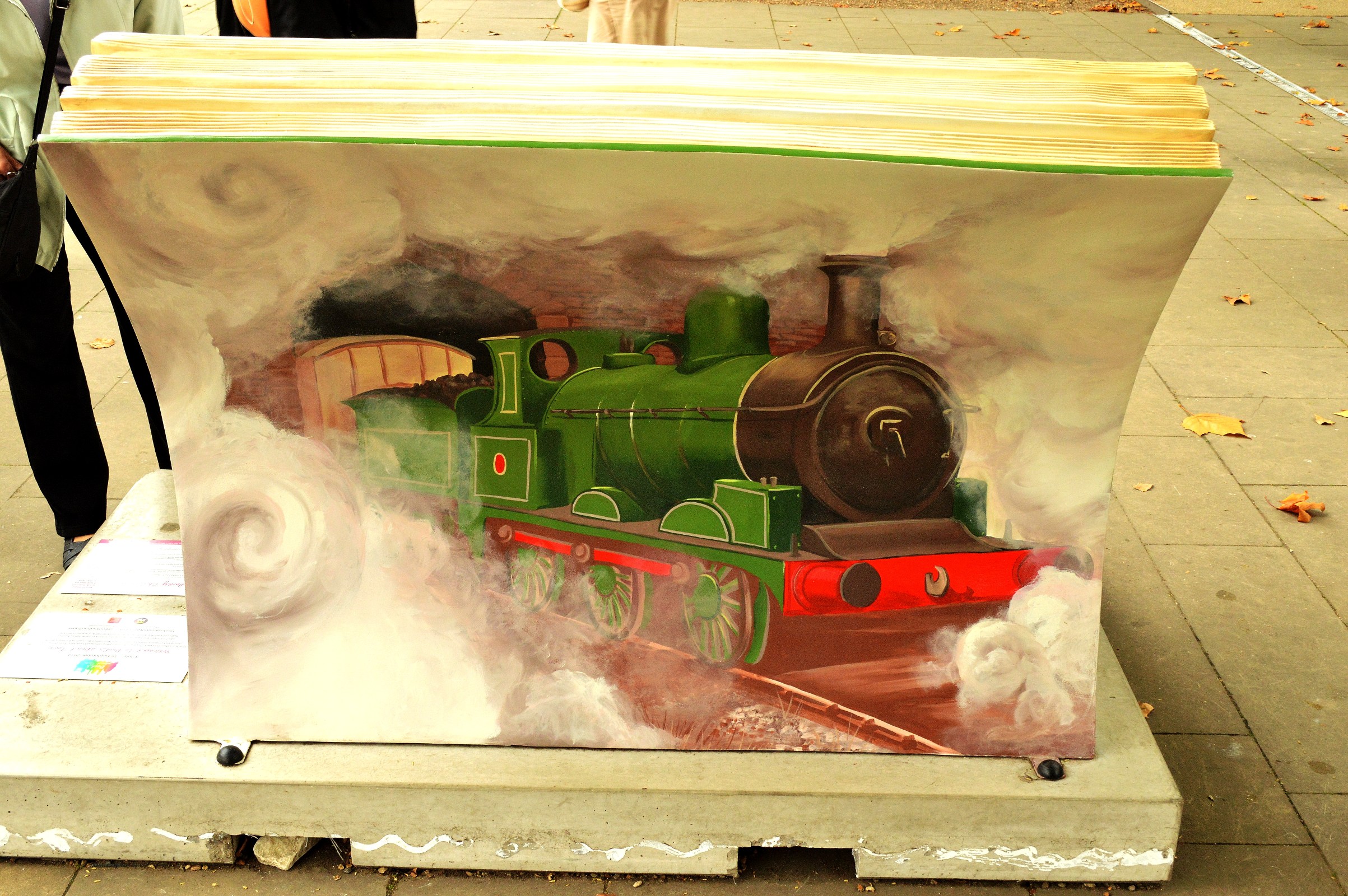
Bench Presses
Books about Town
By popular demand.
The National Literary Trust together with Wild in Art, created the Books About Town project. As result 50 ornate benches were placed around London in early July 2014. Each bench is dedicated to a particular book. The benches will be removed from 15 September 2014 in preparation for auction in October. The auction will raise money for the trust. What a great idea. Just below are a few I managed to photograph in Greenwich and here are all the Books About Town ⇒ and here is More About Greenwich ⇐.

On the Origin of Species – Charles Darwin

The Railway Children – E. Nesbit

The Canterbury Tales – Geoffrey Chaucer

Frozen in Time – Captain Scott

We’re Going on a Bear Hunt – Michael Rosen
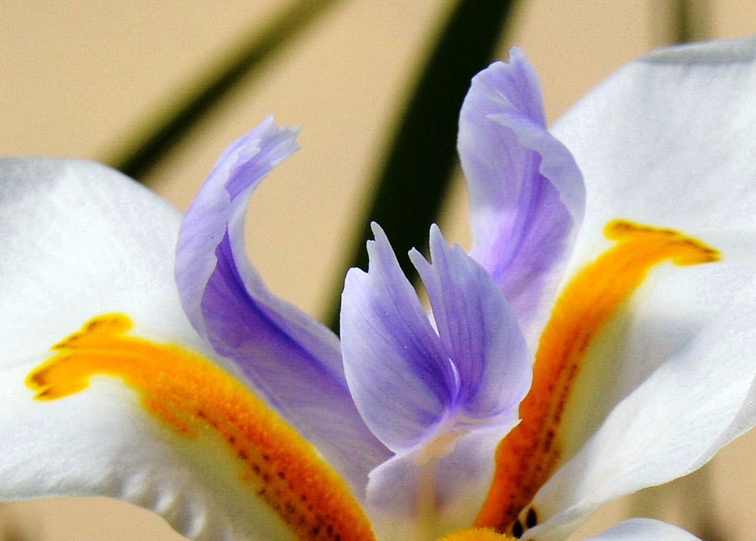
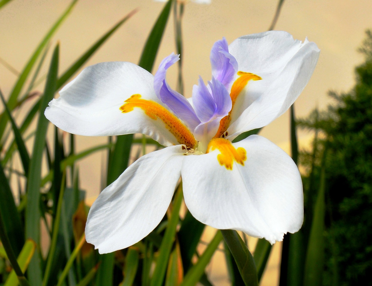
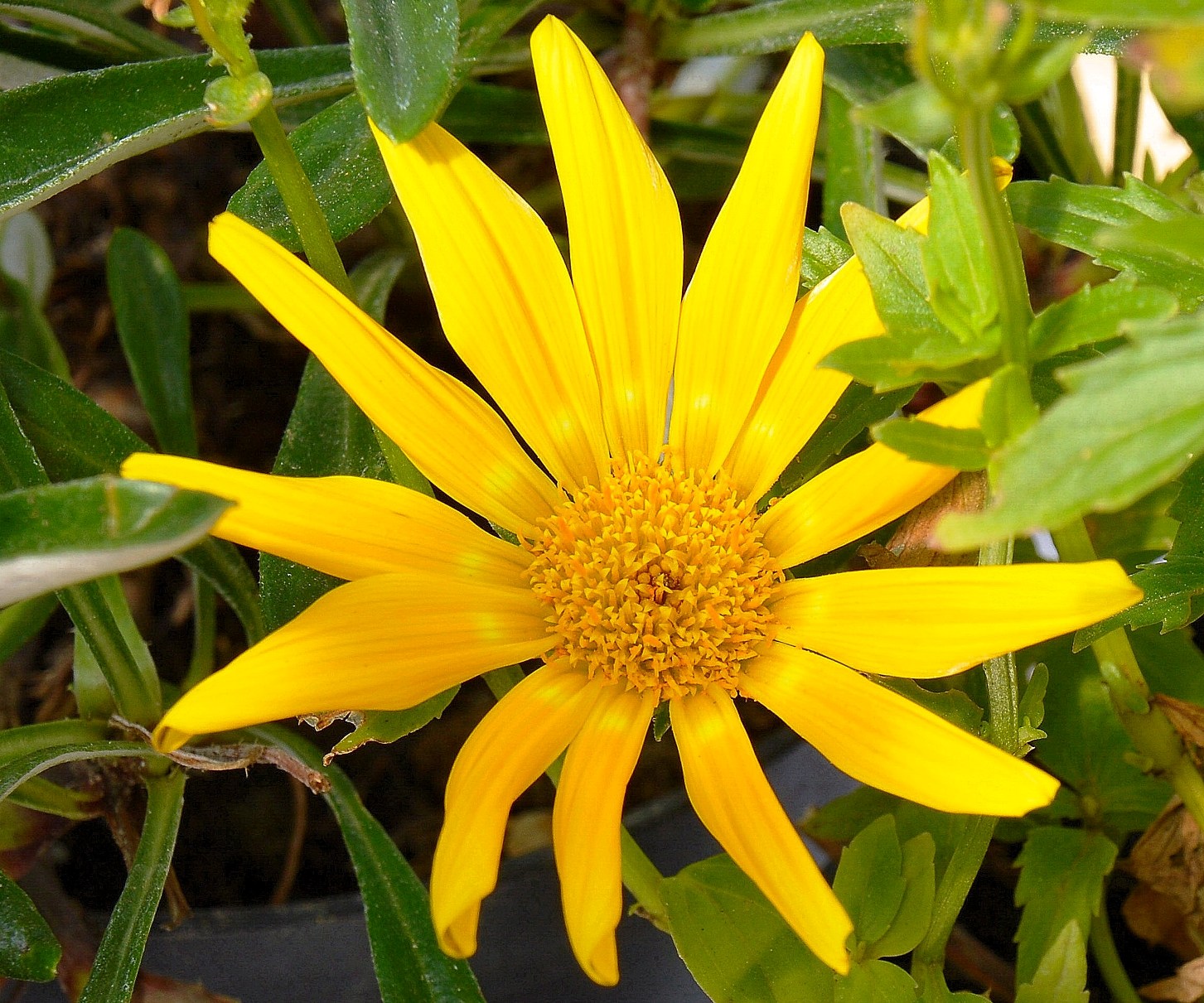
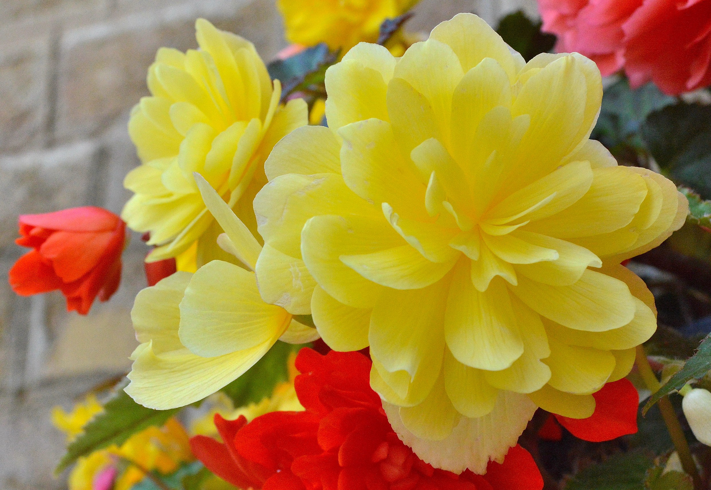
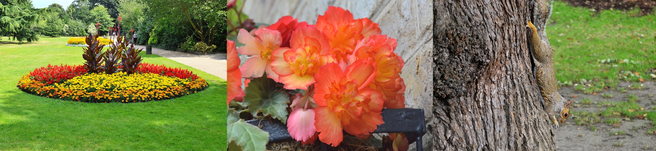
Flowers at Upper Greenwich Gardens
I’m always amazed at the extraordinary detail that can be seen in flora when using more than the human eye. Enjoy 🙂 More of Wonderful Greenwich.


Upper Greenwich Garden Views
11 pics ~ Upper Greenwich Park is a great place to spend a morning and have a picnic. Then wander on to the observatory and from there down the hill for a range of attractions, mostly free. For more information please click on Visiting Wonderful Greenwich.


Now you see me, now you don’t. (a little slideshow)

I’ll jump. Idiot

There is also a deer enclosure but, on the day, they were hiding. ❗
Squirrels in Greenwich Park
At the upper level park.

Your mission, should you wish to accept it, is nuts.

First we catch the nut.
 Then we check to see if it’s suitable for burying or best eaten now.

Then we bury the ones that will keep.

Then we have some fun. Shhimple !

This is one’s just hanging.

But, in a different light. Them paparazzi will demonize anybody, disgraceful. 😛
Squirrels can usually be found at the south east corner of upper Greenwich Park.
The National Maritime Museum, Greenwich
9 Pics. Admission to The National Maritime Museum at Greenwich is free and non-commercial photography does not require a license. There are many other attractions (mostly free) at Greenwich. Please click here for more and for travel information.
The Top Floor Gallery


Horatio Nelson. The painting was commissioned by a friend in Nelson’s younger days
The First Floor Mezzanine


The Ground Floor


I do like the little dog. He looks like a fiercely loyal friend, or a headbanger. 😛
The First Floor
There isn’t a lot on the first floor but it does provide an elevated view of ground floor exhibits.

It was him. No, it was him with the sword. How dare you sir. I will draw my sword and cut off your nose.
No, it was me with the smug expression, and I’ve got a scroll. 😛
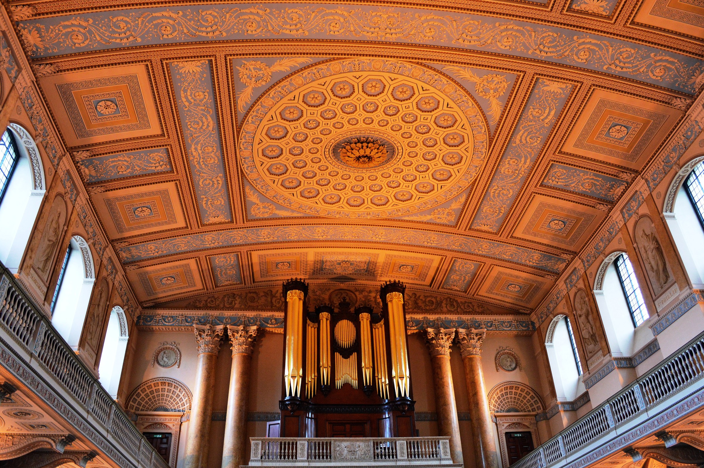
The Chapel at the Naval College, Greenwich
The Chapel
7 Pics – Entrance is free and non-commercial photography is allowed without license. The Painted Hall Pictures. Visiting Wonderful Greenwich and it’s History and Travel to Greenwich and Visitors Map


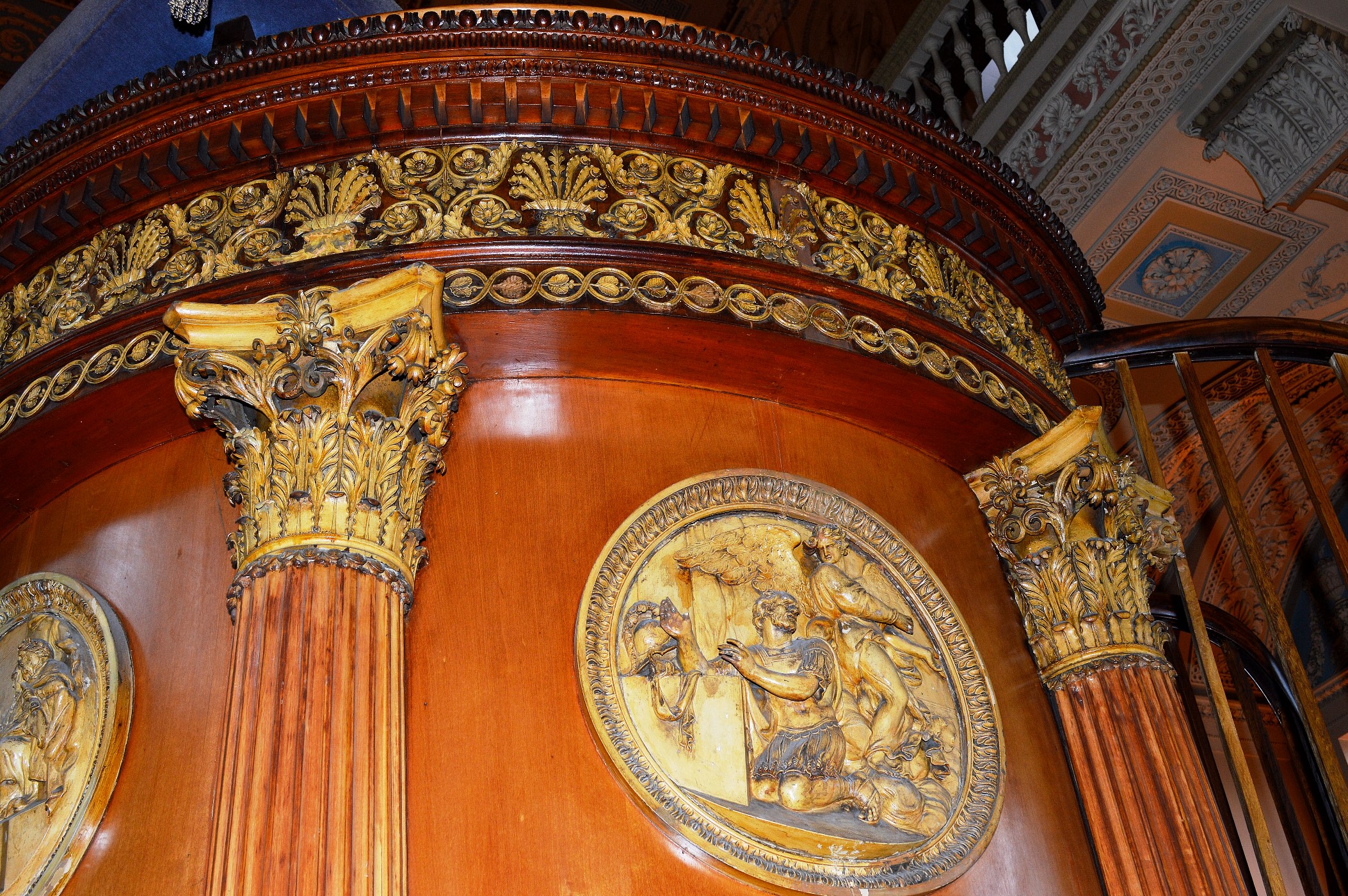
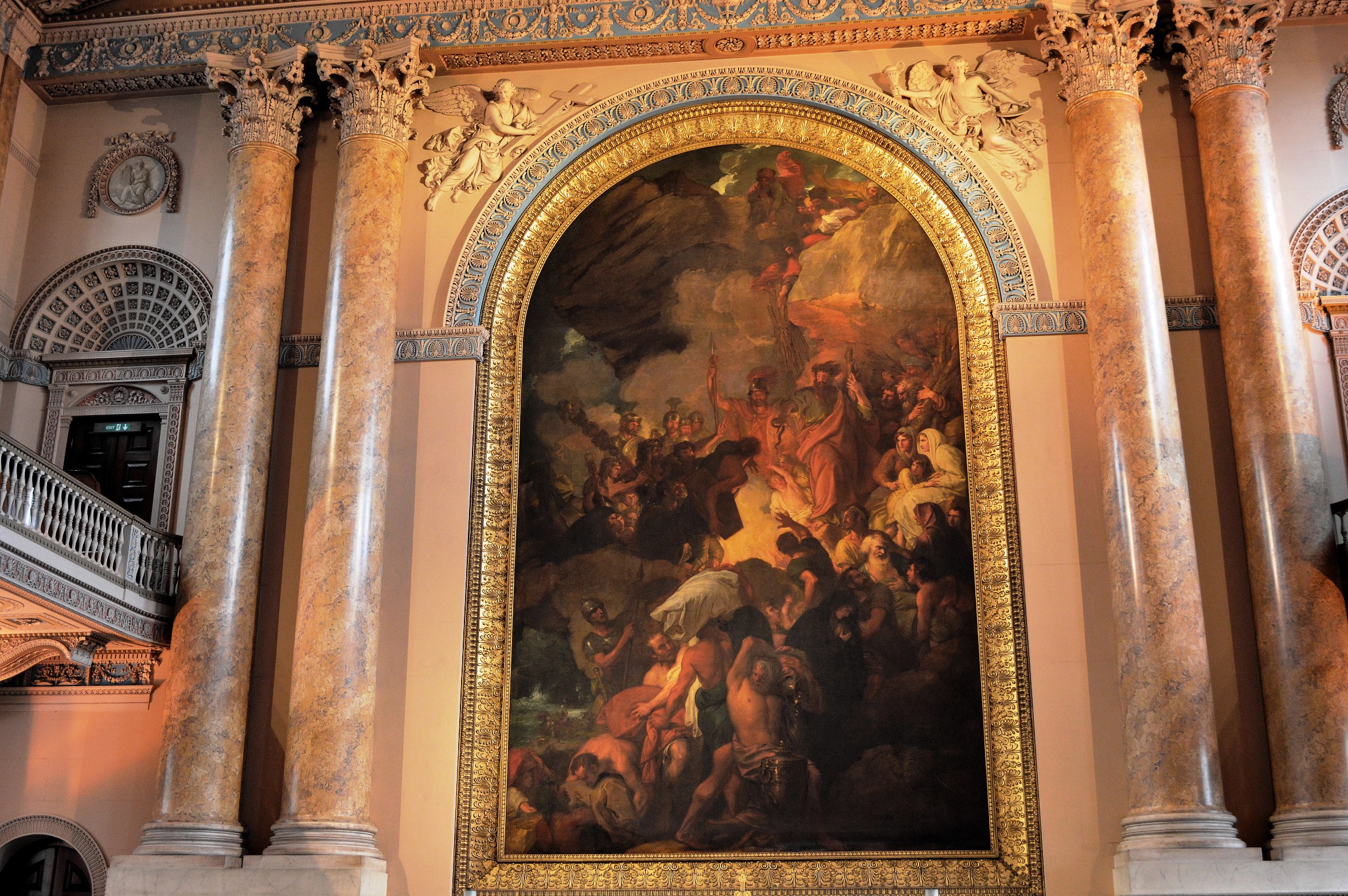

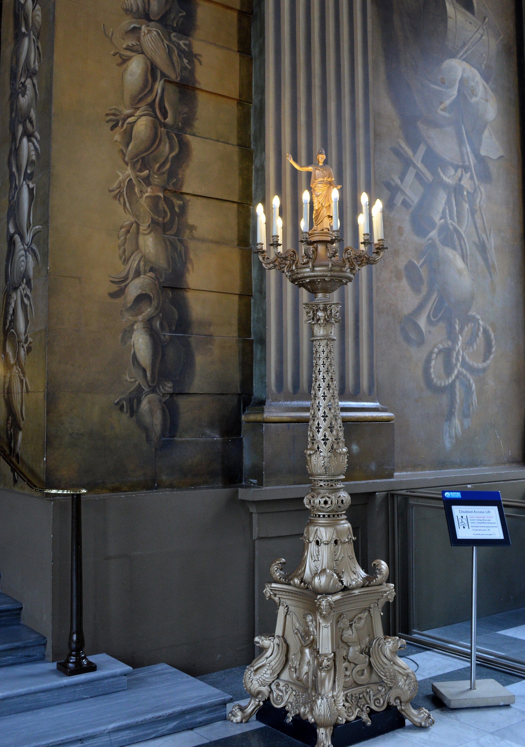
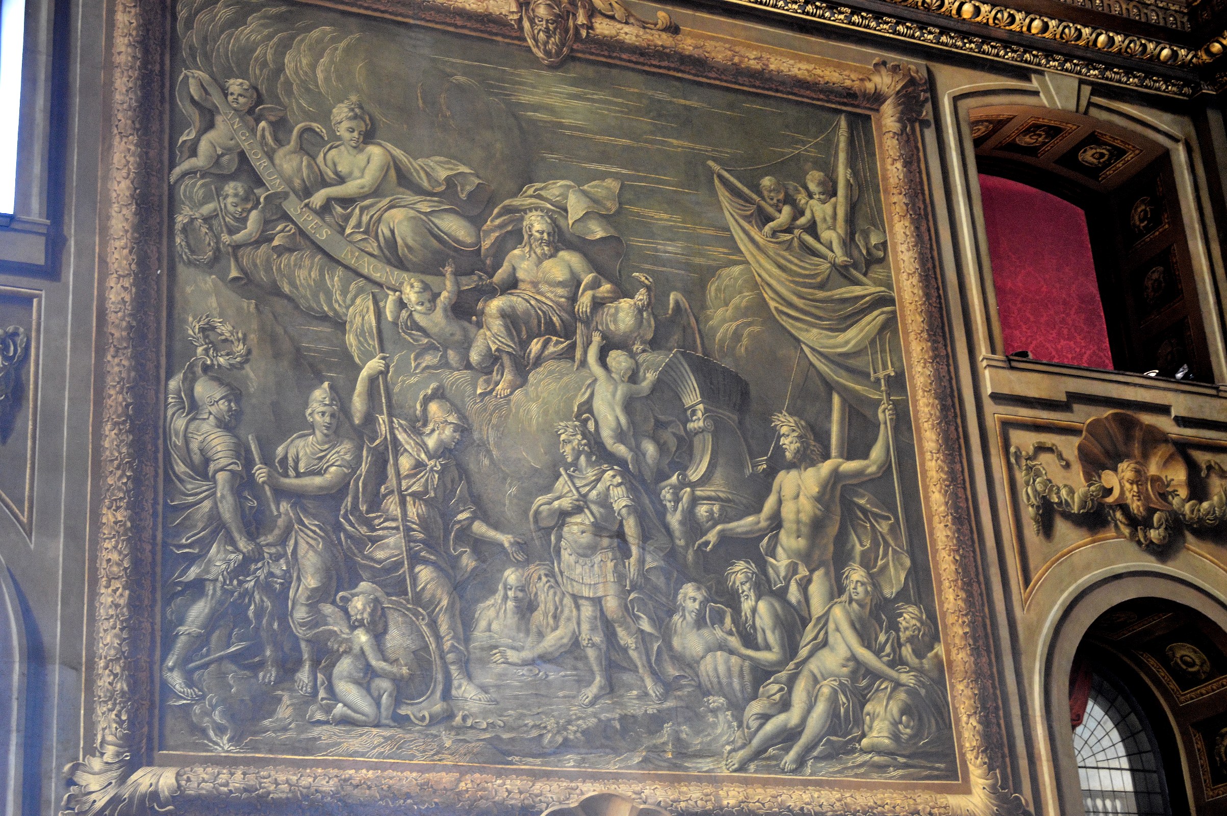
The Painted Hall at the Naval College, Greenwich
The Painted Hall
9 Pics – Entrance is free and non-commercial photography is allowed without licence. The Chapel Pictures. Visiting Wonderful Greenwich and it’s History and Travel to Greenwich and Visitors Map
From May 2017 to early Sept 2017 there is an opportunity to climb trestles for a closer look. There is a charge during this time so please see the website ⇒.


A closer look reveals that shadows are painted on, to give a 3D effect.

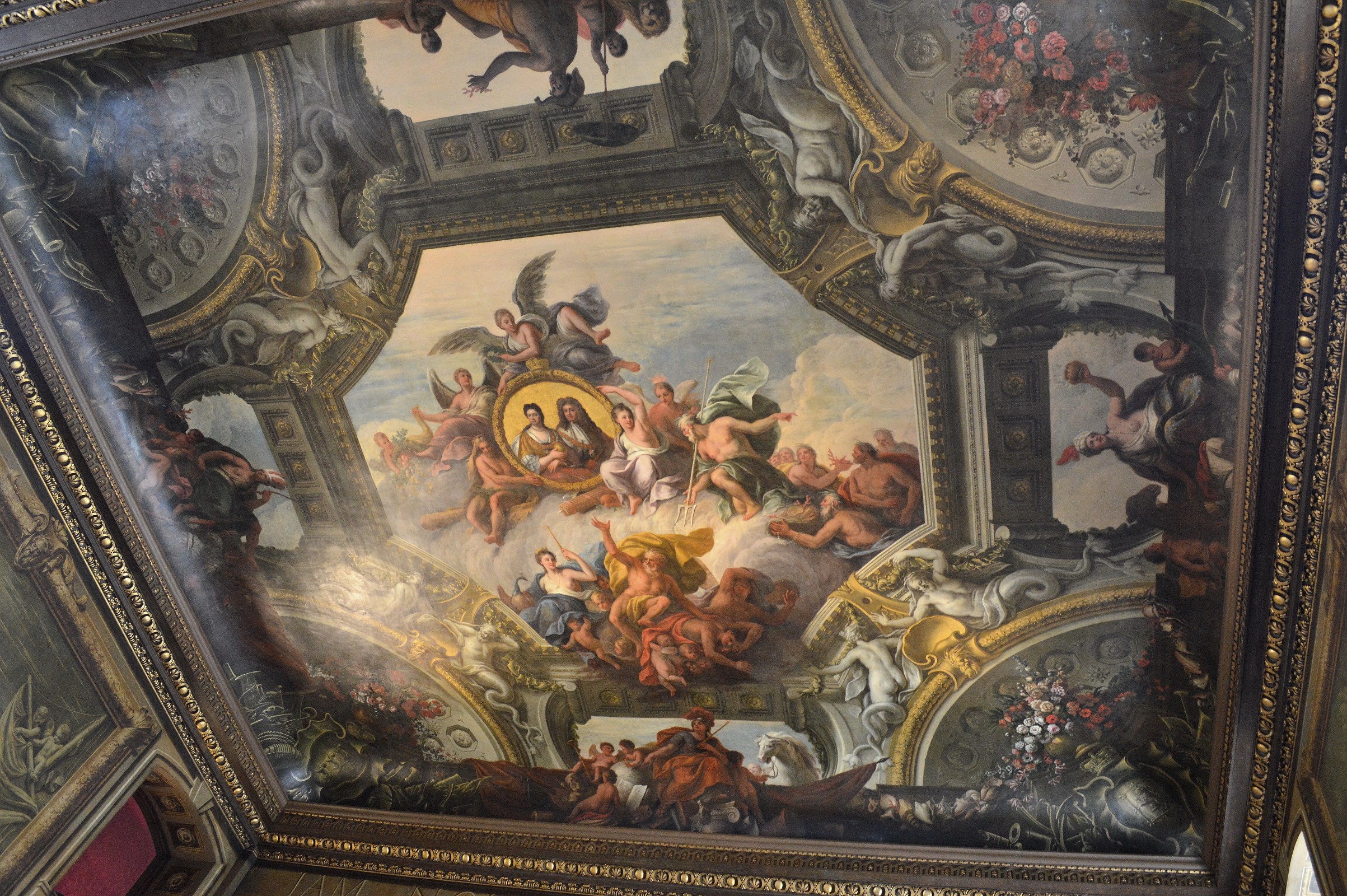
Here again is a 3D effect.
.
At the Greenwich Visitors Centre
A word from our sponsors.
 He’s stone deaf you know.
 It’s very peaceful here.
Wonderful Greenwich and its History
A Great Day Out 
Visiting Maritime Greenwich makes a whole day out and can be for little or no cost (take a picnic) and is one of the best places to photograph in London. It includes the Upper Park Gardens, Deer Enclosure, Royal Naval College, National Maritime Museum, the Queens House, Royal Observatory, Exhibitions, Planetarium, Arts and Crafts Market, Cinema, Comedy Club and a broad range of Restaurants, Cafes and Taverns. The best place to start is at the Upper Gardens and then down the hill.
Greenwich is also a World Heritage site with a wealth of architecture and art of historical interest. At the end of this post is more entertainment information.
Many of the attractions are free and can be photographed and one can stand upon the worlds Prime Meridian at 0 degrees Longitude (see the Tourist Information Map ⇓).
Travel to Greenwich includes maps, best parking, public transport and ways to avoid climbing the hill and you can save the Tourist Information Map as a PDF. The History of Navigation and Greenwich is a more extensive exploration of navigation through the ages,
.
The Upper Gardens
Click on Views Flowers Squirrels
and. although you cannot photograph in there:-
The Rangers House
.
In the Town – Maritime Greenwich
.
The First Shop in the World
Nauticalia is full of seafaring items. It’s at 25 Nelson Rd, that is South past the market and turn left.

It might sound like an excessive boast. Then again it does stand at Longitude 00′ 00′ .4′ West.
.
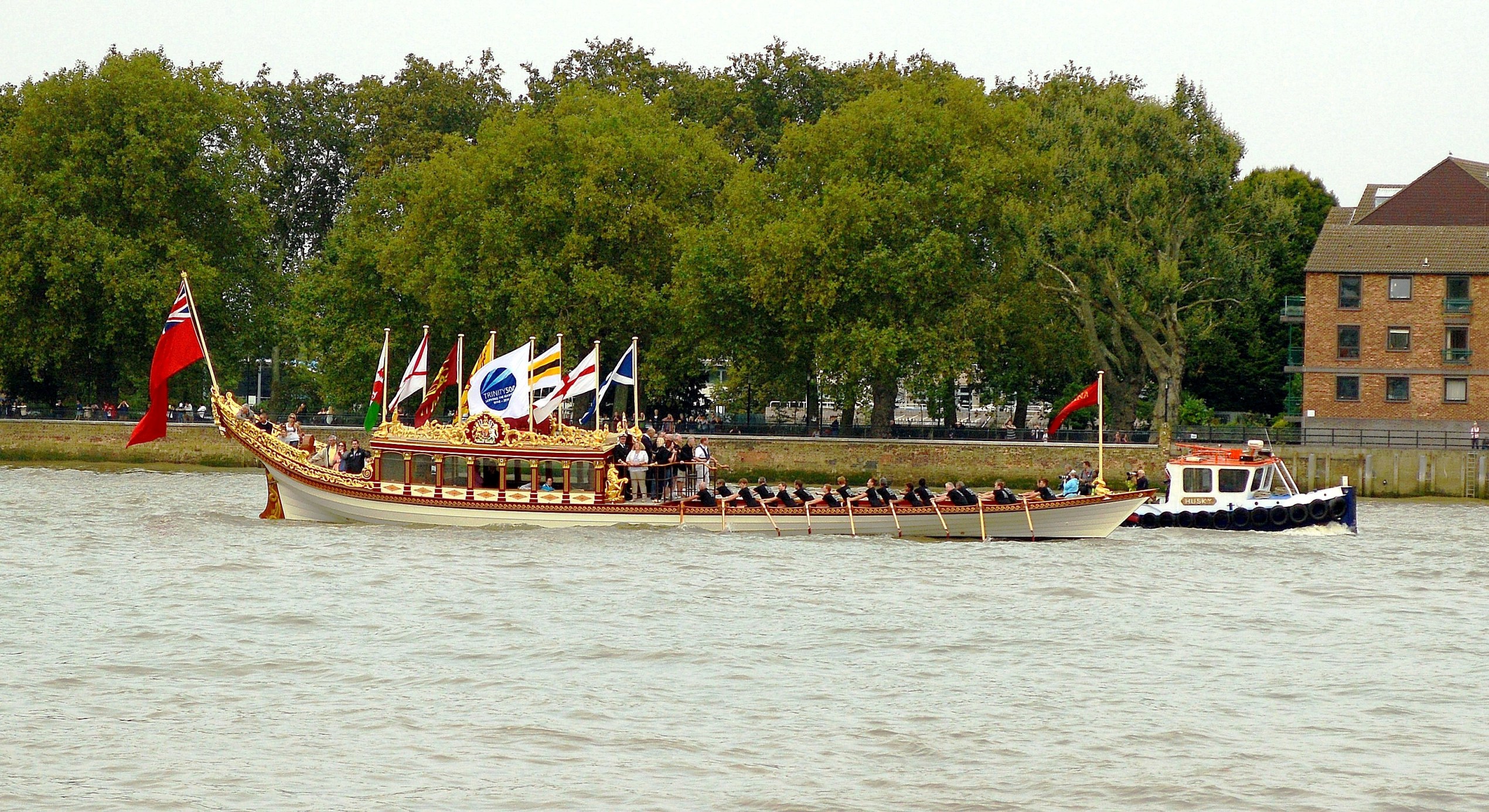
The Cutty Sark

Turn left out of the DLR station, along the short mall and then turn left again.
This great Tea Clipper has been recently restored after a fire during a previous attempt at restoration.
The interior is open to view although it is expensive with many other venues free. Admission.
.
The Royal Naval College
Painted Hall
Designed by Christopher Wren, (currently closed until 2019) admission was free, you could take non-commercial photographs and was definitely worth a visit. More Information and Photographs of the Painted Hall.
It is accessible via the Cutty Sark gate or the West Gate. The visitor center is the best option as a first port of call. Please see the Sitemap.
.
.
.
Chapel
Chapel Photographs Admission is free, you can take non-commercial photographs and is worth visiting.
.
.
.
.
.
.
.
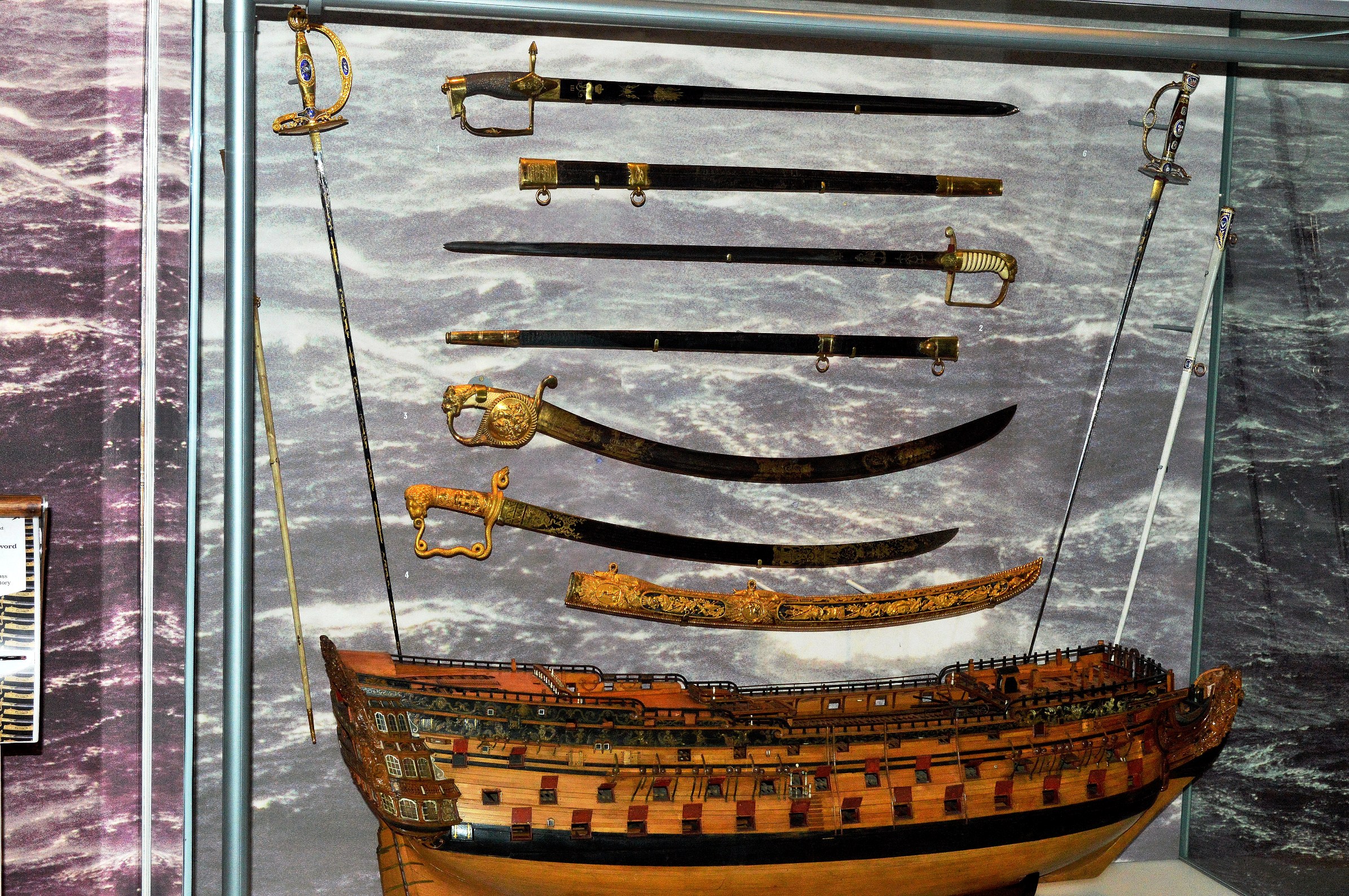
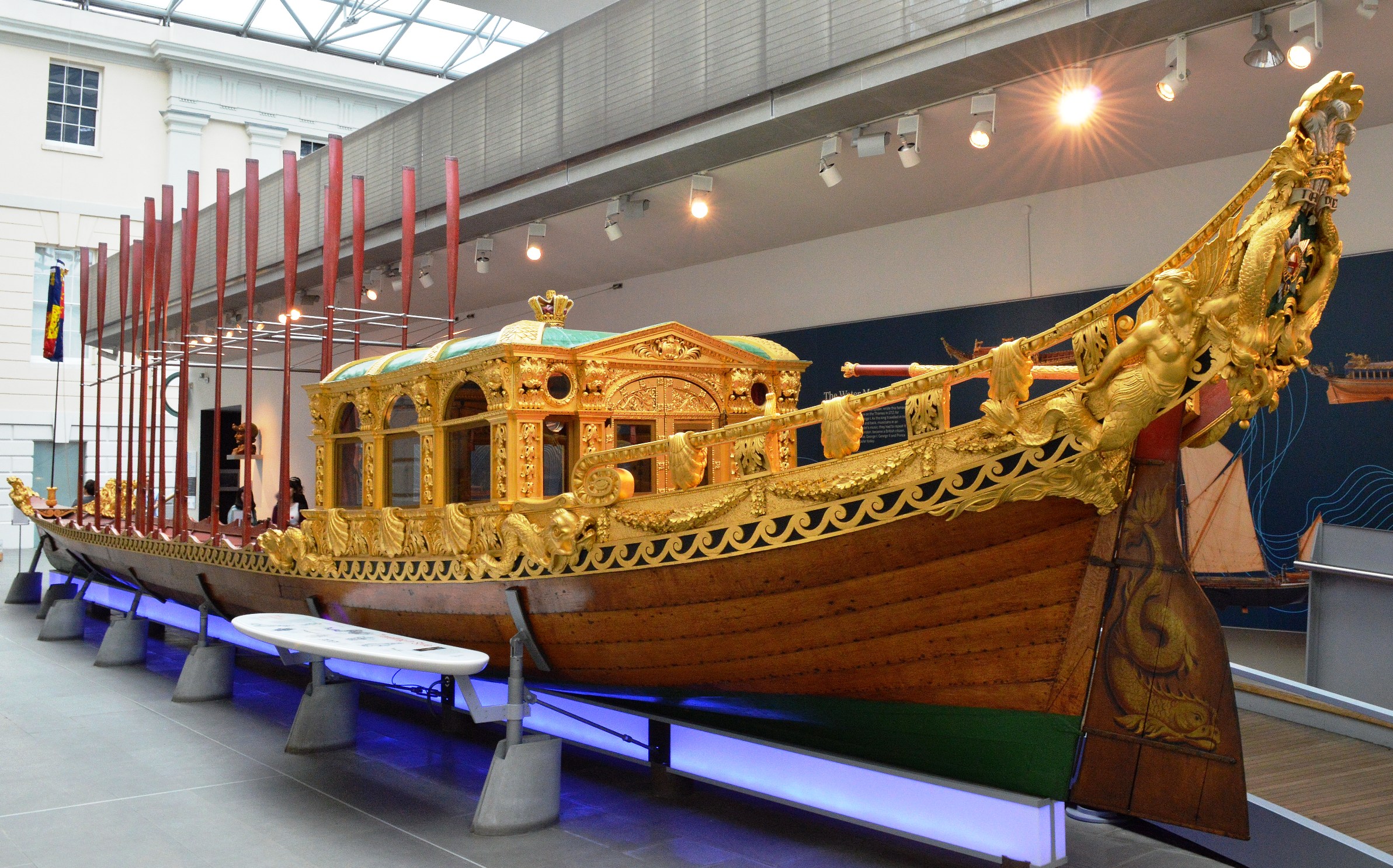
The National Maritime Museum
Admission is also free here, you can take non-commercial photographs and is worth visiting. The Museum.
More Photographs from inside the Museum. However, please bear in mind that the exhibits do change over time.
Behind these buildings, there is the hill which leads to the Royal Observatory and the Planetarium.
.
.
.
.
The Queens House
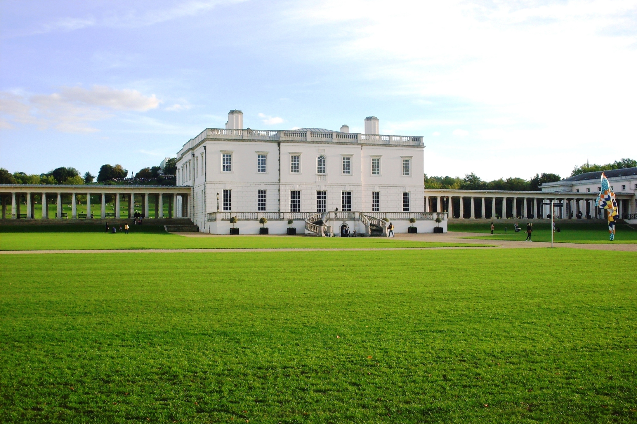
Formally known as Queen Annes House, it is in fact associated with two Queens. Admission is free. The interior architecture and art works mean that it is certainly worth a visit. Non-commercial photography has been allowed since the refurbishment in early 2016.
The Queens House ⇐ History of the Queens House ⇒
.
.
.
The Fan Museum
There is a small charge but you can take non-commercial photographs.
.
.
Greenwich Market
The market offers numerous arts and crafts at reasonable prices. Images from inside the market.
How to find it.
This view is from the South with the park at my back. Using the sitemap, exits from the Naval College, are from the Romney Gate which faces the park or the the West Gate (turn right towards the park).

When facing the other way there is Greenwich Park, with the Queens House, the National Maritime Museum,the Royal Observatory and Planetarium up the hill.
.
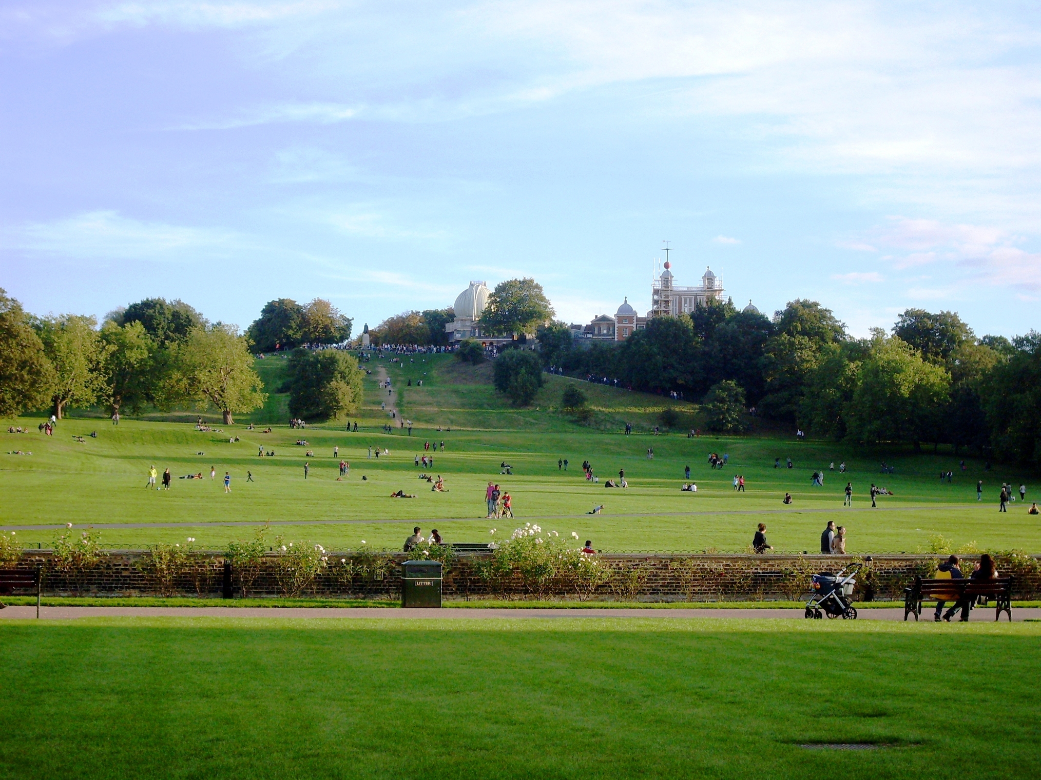
Greenwich Park
The Royal Observatory and Planetarium
The Royal Observatory (see charges) houses the Astronomy Center Gallery (free), the Harrison Timekeepers, the UK’s Largest Refracting Telescope, Flamsteed House and the Meridian Courtyard. The Planetarium, is nearby.
Flamsteed House, Meridian Courtyard, the Harrison Timekeepers and navigation is here ⇐.
View the Tourist Information Map (updated and you can save as a PDF) and discover that there a number of places where one can stand on the Prime Meridian for free and without queuing.
The red ball at the top is used to mark time (either noon or 1 pm) when it dropped so that ships could set their chronometers. It was used instead of a noon day gun because sound takes time to travel. The Time Ball.

The climb is about 140 feet. That’s about the height of a 15 story building. The easiest gradient is by the road to the right. The diagonal route, under the trees has a place to sit about half way up.
The climb can be avoided by traveling around to the plateau beyond, and do the tour in reverse. Please see Travel to Greenwich.
And, you must think I’m daft, if you think I’m going to walk up there.
Turns out you’re right.

Straight on past the observatory is a more landscaped park (see the row of three pics at start) that leads to diagonal roadside parking and the number 53 bus stop.
The West Park
Turning right after the observatory and crossing the road (The Ave ~ Avenue) leads to an untended part of the park.
There one could see a statue by Henry More entitled Knife Edge. It was on loan to the park and may be gone by midsummer 2014. Here are two views of the same statue.


.
.
.
.
.
.
.
.
.
.
.
.
Further on, can be seen a view of Our Lady and Star of the Sea.
There is also another view over London.
The Ave
The Ave ~ Avenue divides the main park and the West side and is closed to all traffic after dusk. With the trees acting as a buffer to sound and light, it is very much like being in the countryside.
It is used by cyclists and the occasional skate boarder, so it wise to stay on the pavement/sidewalk.
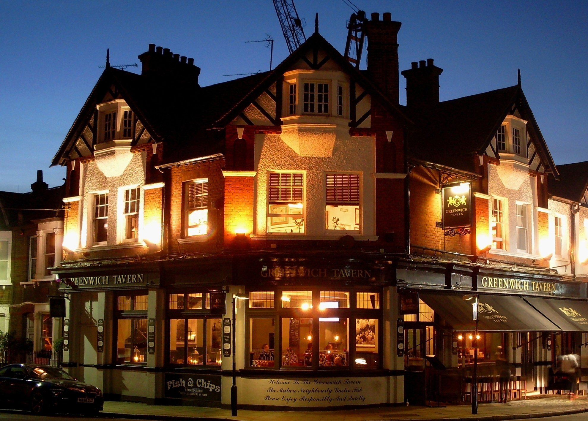
The Ave ~ Avenue continues as King William Walk and at the bottom the welcoming sight of a Tavern.
Greenwich Nightlife
Greenwich also has the Up the Creek Comedy Club on Creek St, a Theater and Picture House
There are numerous Taverns, Pubs, Cafes and Restaurants. Using Google Maps enter any one of those four descriptions.
You can also specify Indian, Vietnamese, Chinese,Thai, Italian, Spanish and French. And, there is a traditional Pie and Mash shop.
The nightlife is generally thriving but gentle. A good place to unwind.
Food and Drink
Like many tourist venues food and drink can be both pricey and pretentious, especially at the park owned venues. Best option is to picnic in the park. On rainy days there is plenty of shelter/benches on the walkway between the Museum and Queens House.
Alternatively, recommended are “The Yacht” and the “Plume of Feathers”. Both to the east of the Naval College.
==================
If you get a chance to visit, I hope you enjoy. 🙂
The Cutty Sark
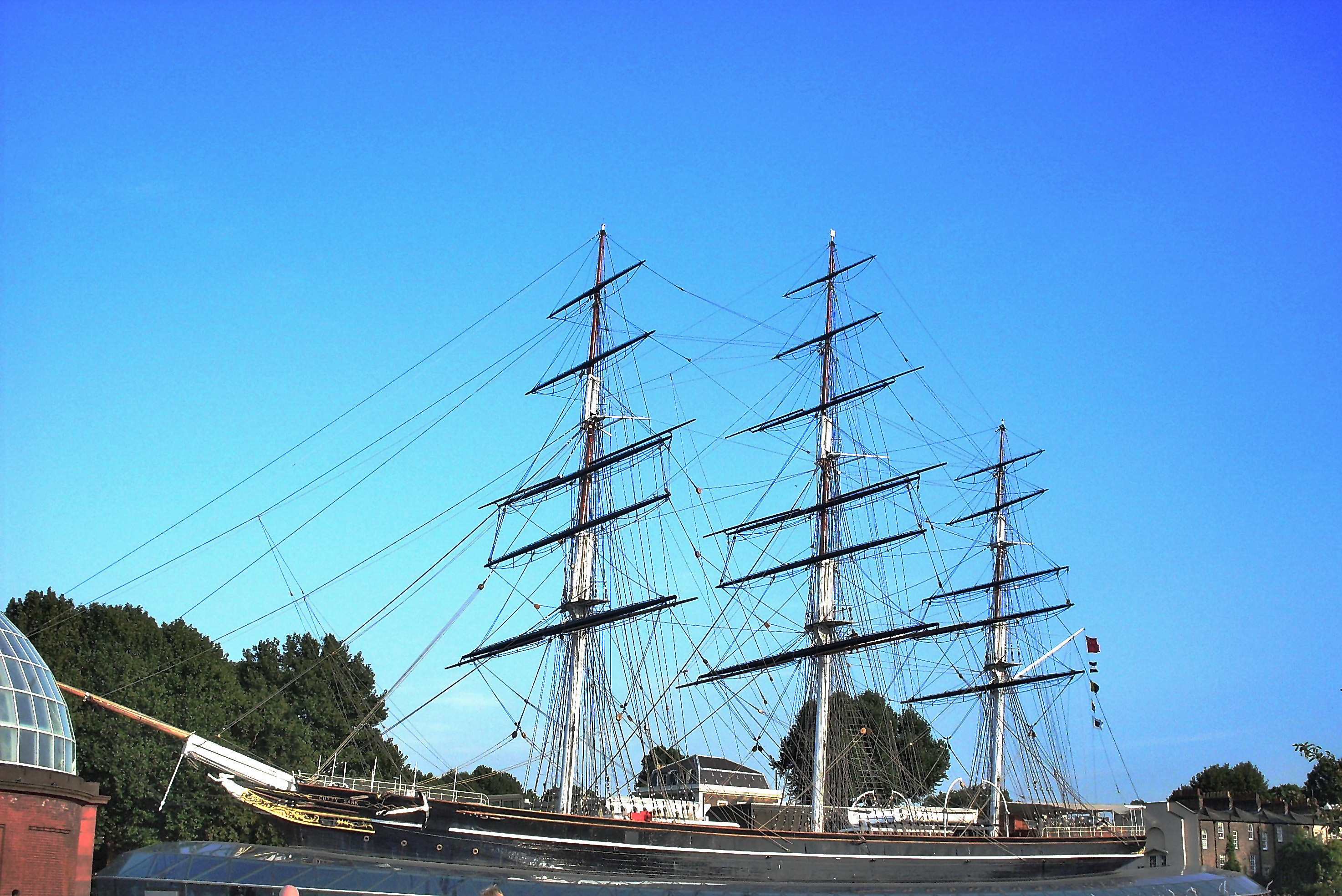
The Cutty Sark and the legacy of the great sailing ships
The Cutty Sark is now on show at Greenwich (London,UK). It is the last remaining example of the great Tea Clippers. For more information about the exhibit please click here.
The first of each tea harvest from China to Europe was of great commercial value. These ships were built for that purpose, using a narrow hull and powerful rig. Built for speed rather than large cargo. For more of that history please click here.
The Cutty Sark was recognised as the foremost in its class even though it never quite won the Great Tea Race.
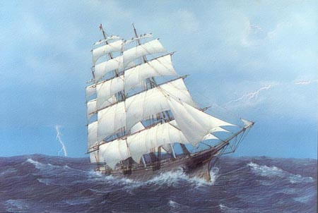
This is another Clipper Ship, Lightning under full sail.
Provided under Creative Commons License by: Bruce Von Stetina
Ships like these and their crews advanced the knowledge of construction, navigation and seamanship. Altogether making travel by sea a lot safer than it used to be. It was once the most hazardous of all occupations. By contrast, going to sea has now become a pleasure to many.
An important principle still remains for all such potentially hazardous occupations. That is, the development of good habit. Often inconvenient in good weather but a vital life safer when wet, cold, tired, in the dark, confused and disoriented.
Such vessels do not remain in service and their builders and brave crews are no longer with us. But, the advances that they made remain. Those ships and their crews may not still roll, but because of their legacy, they still rock.
Thank you for visiting Freed From Time
The History of Navigation and Greenwich
 ⇐ Visiting Wonderful Greenwich.
Observation of the sun and stars were the beginning of navigation.
Without the benefits of having a North Star and Southern Cross, early navigation would have been very much delayed. As a result of this alone, all the benefits of trade and the distribution of knowledge would have been delayed.
The great and difficult steps, towards more advanced navigation were also essential to that development.
Right now we could still be without electricity, advanced medicine or even indoor plumbing.
Greenwich and the Greenwich Meridian have been central to the completion of the navigational puzzle.
.
.
.
.
.
Here is a brief history of that struggle, to navigate the world safely .
The North Star
It is always useful to know how to find the North Star (Polaris) or the Southern Cross (Crux)
This diagram shows part of the Great Bear (Ursa Major) constellation also known as the Panhandle. During the night this rotates around the sky but its lip always points towards Polaris.

The star itself is only of medium brightness but is quite alone in its position. It points so consistently close to due north that it can be reliably used for navigation.
It can be seen all over the Northern Hemisphere and, from some places, just south of the equator. More about the North Star.

The Southern Cross
The Southern Cross consists of four bright stars and also remains in a constant position in the sky. It can be seen all over the Southern Hemisphere and in some places north of the equator. More about the Southern Cross.
.
.
.
.
The Sun Compass
At noon when the sun is highest, it will be due South when seen from the Northern Hemisphere (or North if seen from the Southern Hemisphere). Its shadow points the other way. Without the advantage of a clock, direction cannot be found except at noon.
These days you can use a dial watch.
Rotate your watch so that the hour hand is pointing in the direction of the sun (keeping the watch flat). A line halfway between the hour hand and 12 o’clock is pointing due South (or North if in the Southern Hemisphere).
Why halfway ? It’s only a 12 hour watch. If its digital, then I’m sorry but you’re out of luck.
The ancients cleverly designed a simple combination of sun-dial (clock) and direction finder.
 Throughout one day the shadow of the sun is marked on the dial, which is kept in a fixed position.
During the following days, the compass is periodically rotated so that the sun’s shadow touches the nearest marked position. The noon mark, which is the shortest shadow mark, then points North (or South if in the Southern Hemisphere). By this method, direction can be found throughout the day.
As the days pass the height of the sun changes and the sun compass needs to be updated.
The Vikings, who were great travelers, used these sun compasses. The principle remains correct and a simple device can made quite easily. The wooden palette doesn’t even need to be round. A short plank of wood with a hole for a pencil shadow maker will do.
Latitude and Longitude
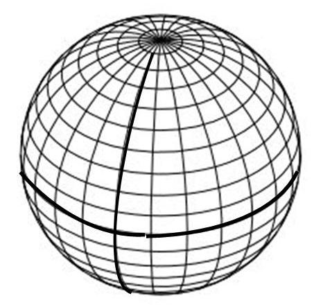 The lines of latitude are horizontal and are an equal distance from each other around the world. The thicker line is the equator at 0 degrees Latitude
The lines of Longitude are vertical and narrow towards the poles. The thicker line is the Prime Meridian at 0 degrees Longitude.
Knowing One’s Position North/South – Latitude
There is now some evidence to suggest that the Vikings used additional marks on their sun compasses to note the height of the sun, by its angle above the horizon.
Did the Vikings calculate latitude ?
Measuring the angle of the sun above the horizon, together with suitable tables of information for each day of the year, enables a navigator to determine position North or South of the Equator. That is, in angular degrees of Latitude.
Here is how two different positions would result in two different observations of the sun’s height above the horizon at noon.

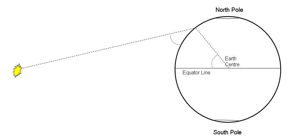
Latitude is therefore measured in degrees of angle. Either 0 to 90 degrees North of the equator or 0 to 90 degrees South of the equator.
If a navigator can determine Latitude then it is possible to cross an ocean to a known location. More importantly, the vessel can return to its original home Latitude.
In practice, because the earth is tilted upon its axis, numeric tables are required to compensate according to the time of year.
The sextant and magnetic compass were invented before the problem of finding Longitude (ones East/West position) was solved.
The Sextant
A sextant is a more accurate means of measuring the sun’s height above the horizon at noon (the sun’s angle of altitude) and therefore determining ones Latitude. It can also be used to navigate by the stars. More about sextants.
The Magnetic Compass
The magnetic compass is either a needle or a dial which points to the magnetic north pole.
Variation: The magnetic North Pole is not in the same position as the True North Pole. The difference is referred to as variation or declination and must be accounted for when plotting a course.
This variation changes slowly from year to year. However, due to fluctuations in the earths magnetic field, there can considerable difference in variation from place to place. Variation can be as much as 20 degrees either East or West of True North.
To avoid any confusion, compass angles are still referred to as either True or Magnetic.
Deviation: A compass will be affected by nearby metal. Even the old wooden ships had many iron nails and metal fittings. The iron ships had even more of a problem. This effect is termed deviation and is solved in one of three ways, either:-
Small vessels use a graph which shows the effect according to which way the vessel is pointing.
Larger vessels once used a Binnacle. This is a column upon which the compass stands and includes a number of corrective magnets.
In more recent decades, gyro compasses have been used and are described later.
The Problem of Longitude
Longitude is a position to east or west of a fixed line that runs from pole to pole. Such a line is referred to as a meridian.
Latitude by itself is not sufficient for the creation of accurate maps or sea charts. Without accurate charts, and a means to determine both ones Latitude and Longitude, a vessel is at extreme risk of striking reefs, underwater rocks and sandbanks. At night or in fog, a vessel is also at risk from any unseen land mass.
Right up until the 18th century the only method of determining a position East or West of ones starting point was by dead reckoning. That is, by measuring the distance traveled.
At sea, this was done by throwing a log over the side attached to a length of rope and measuring out how much rope was paid out over a fixed period of time. The rope had a number of knots at fixed intervals. These were counted out during the emptying of a sand glass.
The method was adjusted over time so that each knot that was pulled overboard indicated a speed of one nautical mile per hour. A nautical mile being equal to 1.151 land miles.
Speed at sea and in the air is still reckoned in knots (i.e. nautical miles per hour).
The information from this log speedometer was entered into a Log Book, which is still used today but contains more information. The term Log Book has been reused for Registration Books, Logging in to work and Logging into a computer.
If they had used a hollow float, we would now be Floating into work and Floating in to our computers. As daft as that may sound, it is no odder than referring to a Log of wood.
Navigation by dead reckoning eventually included vector diagrams that took into account the effect of tidal/current drift and sideways shift due to wind effect (leeway).
The inability to determine accurate Longitude came to a head when ships started to travel longer distances, resulting in many disasters with much loss of life, ships and cargoes.
Solving the Problem of Longitude
In 1567 Phillip II of Spain offered a substantial prize for a solution. The problem was so difficult that it took a further two hundred years to solve. The history of Longitude.
In 1714 the British Government offered a prize of £20,000 (~ £2M today). This eventually resulted in two proposed methods.
One was by observation of the moon’s position. This was very complicated, only of use when the moon was visible and impractical on the rolling decks of a ship.
The other method was by use of an accurate timepiece, which became known as a chronometer. John Harrison did succeed in producing a sufficiently accurate timepiece, and won the prize in 1773 after nearly 30 years of endeavour and just 3 years before his death.
The Board of Longitude, composed of scientists including Sir Isaac Newton, favoured the astronomical method and somewhat delayed giving the prize to a mere clock maker. Nevertheless, they did grant supportive monies along the way.
The Longitude Solution
First, it is necessary to establish a permanent starting point. That is, a fixed line that runs from pole to pole, designated as 0 degrees of Longitude and Prime Meridian.
All places on the earth, being a number of degrees either to the East or to the West of the Prime Meridian.
In practice the Greenwich Meridian (London) was established and is still used.
Then, the navigator’s chronometer must be set to noon, when noon occurs at that meridian. In practice, such timepieces are therefore set to Greenwich Mean Time (GMT).
From 1833 the observatory at Greenwich had a red time ball upon a mast. The time signal was given when the ball dropped. This was better than the usual noon day gun because sound takes time to travel. The Time Ball.
As one travels, sun sightings are taken each day at noon (the noon sight). The further West one travels, the later noon occurs compared with GMT shown by the chronometer.
At the moment of the noon sight, the altitude of the sun is measured to calculate Latitude and the time, on the Greenwich Mean Time chronometer, is used to calculate Longitude.
For example, if the chronometer, at local noon, shows Greenwich Mean Time to be 4 pm then the ship has traveled the same as 4 hours worth of earth’s rotation West of Greenwich. Thus:-

With the appropriate numeric tables and an accurate chronometer, a position can be calculated to less than a mile.
Whilst a degree of Latitude always represents a fixed distance (the lines are parallel), the lines of Longitude narrow towards the poles. Hence, for Longitude, numeric tables are required to turn degrees into nautical miles.
Longitude is measured as 0 to 180 degrees East of the Meridian or 0-180 degrees West of the Meridian. At exactly the opposite side of the world (180 degrees in either direction) is the International Dateline.
.
Understanding the International Dateline: Simple, A Bit More, Headache.
Each of 360 degrees of the earth’s sphere is divided into 60 minutes and each of those divided into 60 seconds.
On minute of Latitude is very nearly a nautical mile. Because lines of Longitude converge towards the poles, the equivalent distances have to be calculated.
Knowing Both Latitude and Longitude
By the late 18th century it was possible to pinpoint one’s position within a visible distance using only a sextant, a chronometer and the relevant tables of information. These days it is possible to do so within a quarter of mile, using the same method.
As a result of this advance it was possible to create accurate charts and safely navigate by them.
This method continued in use up until the age of electronics and has been essential to the development of the modern world.
The Rhumb Line and the Mercator Chart.
One nuisance of a problem had been solved earlier.
If one draws a line on a globe, from one port to another, and then unpeels the globe into a flat chart, the line will become curved. Therefore, to plot a course on such a chart, it is necessary plot it as a curve. This curve is known as a Rhumb line and a considerable nuisance because it must be calculated.
In 1569, before there were any accurate charts, Mercator invented a method of projecting the image of the earth’s globe onto a wall. The resulting charts distorted the land masses but allowed a straight line to be drawn as the shortest course between to places. Mercator projections are still used today.
Port and Starboard
The Vikings used a rudder on the right hand side of their longboats. This was known as the steering board side (Starboard). The left hand side was for the loading board (Larboard).
In 1845 the Secretary of the British Navy ordered the term Larboard side changed to Port side. Somewhere, it is noted that it was probably as result of British ship going aground due to confused communications. Larboard sounding too much like Starboard in a high wind.
Port side lights are Red (like Port wine) whilst Starboard lights are Green. The light, from these two colours, span from each side of the side of the vessel to the front. A small vessel’s rearward light is White.
Large vessels will use a more complicate array.
Modern Navigational Methods
The Gyro Compass: A spinning disk, within a device that allows it to “float”, will retain its orientation, just like a spinning top will stay upright. The application of electrical power will keep such a Gyro spinning. The axis can be set to point North and will continue to do so whilst the ship or aircraft turns around it.
In practice such devices need correction to counteract centrifugal effects. More about the Gyro Compass.
Radio Direction Finding: A simple system of locating two or more land beacons, using a directional receiver, and plotting their directions on a chart. Where the lines cross is one’s positions (referred to as triangulation).
The Decca System: This used a number of land based beacons. A small on-board electronic device then calculated one’s position. It could be as accurate as half a mile but only operated in some parts of the world.
The Global Positioning System: Relying on satellites in fixed orbits, this also uses time. The satellites transmit their position and very accurate time signals.
Using the time signals and the delay caused by distance, it is possible for the GPS unit to determine its distance from each satellite. As result it can calculate its position relative to those satellites.
Then, because the satellites are transmitting their position, the GPS unit can calculate its own position. As Sergai would say “sssimple”, or perhaps not. GPS Basics. More GPS.
Dedication
To all those who risked their lives and all those who tried to save them.
It’s a long way from sailing by the North Star to using GPS.

